world.wikisort.org - Espagne
Miera est une commune espagnole, composée de 11 localités et située dans la communauté autonome de Cantabrie. Elle se situe dans la Vallée encaissée du Río Miera. Son chef-lieu est La Cárcoba (es).
| Miera | |||
 Héraldique |
 Drapeau |
||
| Administration | |||
|---|---|---|---|
| Pays | |||
| Communauté autonome | |||
| Province | |||
| Comarque | Trasmiera (es) | ||
| Code postal | 39727 | ||
| Démographie | |||
| Population | 386 hab. () | ||
| Densité | 11 hab./km2 | ||
| Géographie | |||
| Coordonnées | 43° 16′ 32″ nord, 3° 42′ 43″ ouest | ||
| Altitude | 426 m Min. 961 m Max. 215 m |
||
| Superficie | 3 380 ha = 33,8 km2 | ||
| Localisation | |||

| |||
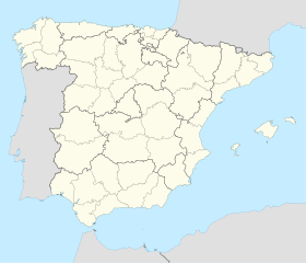
| Géolocalisation sur la carte : Espagne
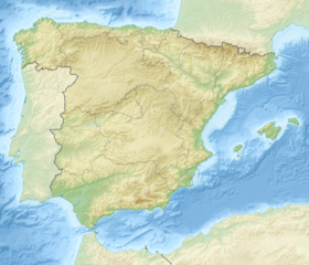
Géolocalisation sur la carte : Espagne
| |||
| modifier |
|||

Démographie
| 1900 | 1910 | 1920 | 1930 | 1940 | 1950 | 1960 | 1970 | 1980 | 1990 | 2000 | 2007 |
|---|---|---|---|---|---|---|---|---|---|---|---|
| 1.489 | 1.413 | 1.389 | 1.313 | 1.141 | 1.187 | 1.107 | 1.011 | 718 | 780 | 532 | 453 |
Source: INE
Notes et références
Notes
- (es) Cet article est partiellement ou en totalité issu de l’article de Wikipédia en espagnol intitulé « Miera (Cantabria) » (voir la liste des auteurs).
Références
- Néant
Voir aussi
Article connexe
- Liste des communes de Cantabrie
Liens externes
- Portail de la Cantabrie
На других языках
[de] Miera (Kantabrien)
Miera ist eine Gemeinde in der spanischen Autonomen Region Kantabrien. Das Gemeindegebiet wird vom gleichnamigen Fluss Miera durchquert und die Gemeinde besteht aus verschiedenen Siedlungen, von denen La Cárcoba der Hauptort ist, 38 km von Santander, der Hauptstadt der Region, entfernt.[en] Miera, Spain
Miera is a municipality located in the autonomous community of Cantabria, Spain.[2] It has a population of 420 inhabitants (2013).[es] Miera (Cantabria)
Miera es un municipio de la comunidad autónoma de Cantabria (España), localizado en el valle de su mismo nombre.- [fr] Miera
[ru] Мьера
Мьера (исп. Miera) — город и муниципалитет в Испании, входит в провинцию Кантабрия в составе автономного сообщества Кантабрия (автономное сообщество). Муниципалитет находится в составе района (комарки) Трасмьера. Занимает площадь 33,8 км². Население — 442 человека (на 2010 год).Текст в блоке "Читать" взят с сайта "Википедия" и доступен по лицензии Creative Commons Attribution-ShareAlike; в отдельных случаях могут действовать дополнительные условия.
Другой контент может иметь иную лицензию. Перед использованием материалов сайта WikiSort.org внимательно изучите правила лицензирования конкретных элементов наполнения сайта.
Другой контент может иметь иную лицензию. Перед использованием материалов сайта WikiSort.org внимательно изучите правила лицензирования конкретных элементов наполнения сайта.
2019-2025
WikiSort.org - проект по пересортировке и дополнению контента Википедии
WikiSort.org - проект по пересортировке и дополнению контента Википедии

