world.wikisort.org - Espagne
Galaroza est une commune de la communauté autonome d'Andalousie, dans la province de Huelva, en Espagne.
Cet article est une ébauche concernant une localité d'Andalousie.
Vous pouvez partager vos connaissances en l’améliorant (comment ?) selon les recommandations des projets correspondants.
| Galaroza | |||||
 Héraldique |
 Drapeau |
||||

| |||||
| Administration | |||||
|---|---|---|---|---|---|
| Pays | |||||
| Communauté autonome | |||||
| Province | |||||
| Code postal | 21291 | ||||
| Démographie | |||||
| Population | 1 373 hab. () | ||||
| Densité | 62 hab./km2 | ||||
| Géographie | |||||
| Coordonnées | 37° 55′ nord, 6° 42′ ouest | ||||
| Altitude | 564 m |
||||
| Superficie | 2 200 ha = 22 km2 | ||||
| Localisation | |||||
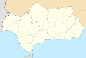
| Géolocalisation sur la carte : Espagne
Géolocalisation sur la carte : Espagne
Géolocalisation sur la carte : Andalousie
Géolocalisation sur la carte : province de Huelva
| |||||
| modifier |
|||||


Géographie
Cette section est vide, insuffisamment détaillée ou incomplète. Votre aide est la bienvenue ! Comment faire ?
Histoire
Cette section est vide, insuffisamment détaillée ou incomplète. Votre aide est la bienvenue ! Comment faire ?
Administration
Cette section est vide, insuffisamment détaillée ou incomplète. Votre aide est la bienvenue ! Comment faire ?
 Portail de l’Andalousie
На других языках
[de] Galaroza
Galaroza ist eine spanische Gemeinde in der Provinz Huelva in Andalusien. Die Gemeinde ist bekannt für ihr Wasser und für kunsthandwerkliche Holzarbeiten.[en] Galaroza
Galaroza is a town and municipality located in the Parque Natural de la Sierra de Aracena y Picos de Aroche,[2] which is in the province of Huelva, Spain. According to the 2005 census, the city has a population of 1,642 inhabitants. In 2015 this figure decreased to 1,560.[3][es] Galaroza
Galaroza es un municipio y localidad española de la provincia de Huelva, en la comunidad autónoma de Andalucía. Se encuentra situado en pleno parque natural Sierra de Aracena y Picos de Aroche. Cuenta con dos pedanías: Navahermosa y Las Chinas.- [fr] Galaroza
[ru] Галароса
Галароса (исп. Galaroza) — населённый пункт и муниципалитет в Испании, входит в провинцию Уэльва, в составе автономного сообщества Андалусия. Муниципалитет находится в составе района (комарки) Сьерра-де-Уэльва. Занимает площадь 22 км². Население — 1606 человек (на 2010 год). Расстояние — 117 км до административного центра провинции.Текст в блоке "Читать" взят с сайта "Википедия" и доступен по лицензии Creative Commons Attribution-ShareAlike; в отдельных случаях могут действовать дополнительные условия.
Другой контент может иметь иную лицензию. Перед использованием материалов сайта WikiSort.org внимательно изучите правила лицензирования конкретных элементов наполнения сайта.
Другой контент может иметь иную лицензию. Перед использованием материалов сайта WikiSort.org внимательно изучите правила лицензирования конкретных элементов наполнения сайта.
2019-2026
WikiSort.org - проект по пересортировке и дополнению контента Википедии
WikiSort.org - проект по пересортировке и дополнению контента Википедии