world.wikisort.org - Espagne
El Rosario est une commune de la province de Santa Cruz de Tenerife dans la communauté autonome des Îles Canaries en Espagne. Elle est située au nord-est de l'île de Tenerife.
Cet article est une ébauche concernant une localité des îles Canaries.
Vous pouvez partager vos connaissances en l’améliorant (comment ?) selon les recommandations des projets correspondants.
Pour les articles homonymes, voir El Rosario.
| El Rosario | |||||
 Héraldique |
 Drapeau |
||||
 Vue de Tabaiba dans la commune d'El Rosario. | |||||
| Administration | |||||
|---|---|---|---|---|---|
| Pays | |||||
| Communauté autonome | |||||
| Province | |||||
| Île | |||||
| Comarque | Área Metropolitana | ||||
| District judic. | Santa Cruz de Tenerife | ||||
| Maire Mandat |
Escolástico Gil Hernández (Iniciativa por El Rosario-Los Verdes) 2015 |
||||
| Code postal | 38109, 38190, 38290, 38510 | ||||
| Démographie | |||||
| Gentilé | Esperancero/a | ||||
| Population | 17 590 hab. () | ||||
| Densité | 446 hab./km2 | ||||
| Géographie | |||||
| Coordonnées | 28° 27′ 00″ nord, 16° 22′ 00″ ouest | ||||
| Altitude | 905 m |
||||
| Superficie | 3 943 ha = 39,43 km2 | ||||
| Bordée par | Océan Atlantique | ||||
| Localisation | |||||
| Géolocalisation sur la carte : Tenerife
Géolocalisation sur la carte : Îles Canaries
Géolocalisation sur la carte : Îles Canaries
Géolocalisation sur la carte : Espagne
| |||||
| Liens | |||||
| Site web | www.ayuntamientoelrosario.org | ||||
| modifier |
|||||

Géographie
El Rosario est située au sud de Santa Cruz de Tenerife, au nord-est d'Arona et à l'est de Icod de los Vinos et Puerto de la Cruz.
Localisation

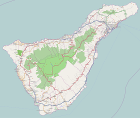
Localisation de l'île de Tenerife
dans les Îles Canaries.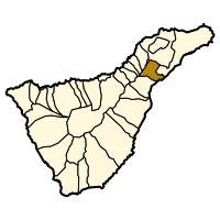
Localisation d'El Rosario
dans l'île de Tenerife.


Villages de la commune
- La Esperanza (siège administratif)
- Barranco Hondo
- Las Barreras
- Lomo Pelado
- Llano del Moro
- Machado
- Radazul
- Las Rosas
- El Chorillo (San Isidro)
- Tabaiba
- Llano Blanco
- Boca Cangrejo
- Costa Caricia
- Costanera
Transports
- TF-1
- Route ancienne de Santa Cruz de Tenerife - Arona
Démographie
| Année | Population | Densité |
|---|---|---|
| 1842 | 1.609 | 40,81/km² |
| 1900 | 2.866 | 72,69/km² |
| 1930 | 4.599 | 116,64/km² |
| 1950 | 6.328 | 160,49/km² |
| 1991 | 8.103 | 205,5/km² |
| 1996 | 10.880 | 275,93/km² |
| 2001 | 13.462 | 345,17/km² |
| 2002 | 13.718 | 347,91/km² |
| 2003 | 14.862 | 377,13/km² |
| 2004 | 15.542 | 390,99/km² |
| 2005 | 16.024 | 406,39/km² |
| 2009 | 17.182 | 435,76/km² |
Notes et références
Voir aussi
Articles connexes
- Liste des communes des îles Canaries
- Liste des communes de la province de Santa Cruz de Tenerife
Lien externe
 Portail des îles Canaries
На других языках
[de] El Rosario
El Rosario ist ein Gemeindebezirk mit 17.370 Einwohnern (Stand 1. Januar 2019) im Nordosten der Kanareninsel Teneriffa. Sie ist mit der östlichen Nachbargemeinde Santa Cruz de Tenerife über die Südautobahn TF-1 verbunden. Weitere Nachbargemeinden sind San Cristóbal de La Laguna im Norden, Candelaria im Süden, La Matanza de Acentejo und El Sauzal im Westen und Tacoronte im Nordwesten.[en] El Rosario, Tenerife
El Rosario is a municipality in the northeastern part of the island of Tenerife in the Santa Cruz de Tenerife province, on the Canary Islands, Spain. The seat of the municipality is the town La Esperanza, in the mountainous interior of the island. The municipality includes the coastal town Radazul. The TF-1 motorway passes through the southern part of the municipality.[es] El Rosario (Tenerife)
El Rosario es un municipio perteneciente a la provincia de Santa Cruz de Tenerife, en la isla de Tenerife, Canarias, España. La capital municipal es La Esperanza, situada a 900 m s. n. m..- [fr] El Rosario (Tenerife)
[ru] Эль-Росарио (Испания)
Эль-Росарио (исп. El Rosario) — город и муниципалитет в Испании, входит в провинцию Санта-Крус-де-Тенерифе в составе автономного сообщества Канарские острова. Находится на острове Тенерифе. Занимает площадь 39,42 км². Население 17417 человек (на 2010 год).Текст в блоке "Читать" взят с сайта "Википедия" и доступен по лицензии Creative Commons Attribution-ShareAlike; в отдельных случаях могут действовать дополнительные условия.
Другой контент может иметь иную лицензию. Перед использованием материалов сайта WikiSort.org внимательно изучите правила лицензирования конкретных элементов наполнения сайта.
Другой контент может иметь иную лицензию. Перед использованием материалов сайта WikiSort.org внимательно изучите правила лицензирования конкретных элементов наполнения сайта.
2019-2026
WikiSort.org - проект по пересортировке и дополнению контента Википедии
WikiSort.org - проект по пересортировке и дополнению контента Википедии