world.wikisort.org - Spain
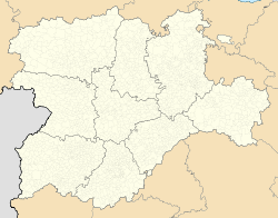
Santa María de Huerta is a municipality located in the Campo de Gómara comarca, Province of Soria, Castile and León, Spain beside the A2 autopista and close to the border with Aragon. According to the 2004 census (INE), the municipality has a population of 419 inhabitants.
This article does not cite any sources. (January 2013) |
Santa María de Huerta | |
|---|---|
Municipality | |
 Monasterio de Santa María de Huerta | |
 Coat of arms | |
 Santa María de Huerta Location in Spain.  Santa María de Huerta Santa María de Huerta (Spain) | |
| Coordinates: 41°15′53″N 2°10′33″W | |
| Country | |
| Autonomous Community | |
| Province | |
| Comarca | Campo de Gómara |
| Government | |
| • Type | Mayor-council government |
| • Body | Ayuntamiento de Santa María de Huerta |
| • Mayor | Mercedes Aguilar Medina (2015) (AISMH) |
| Area | |
| • Total | 49.15 km2 (18.98 sq mi) |
| Elevation | 762 m (2,500 ft) |
| Population (2018)[1] | |
| • Total | 267 |
| • Density | 5.4/km2 (14/sq mi) |
| Demonym(s) | Hortense, -sa (es) |
| Time zone | CET (GMT +1) |
| • Summer (DST) | CEST (GMT +2) |
| Postcode | 42260 |
| Website | Official website |
The village contains the Cistercian monastery of Santa María de Huerta.
References
- Municipal Register of Spain 2018. National Statistics Institute.
Municipalities in the province of Soria | ||
|---|---|---|
| 30,000+ |
|  |
| 1,000+ |
| |
| under 1,000 |
| |
This article about a location in the province of Soria, Spain is a stub. You can help Wikipedia by expanding it. |
На других языках
- [en] Santa María de Huerta
[es] Santa María de Huerta
Santa María de Huerta es un municipio español de la provincia de Soria, en la Comunidad Autónoma de Castilla y León.[ru] Санта-Мария-де-Уэрта
Санта-Мария-де-Уэрта (исп. Santa María de Huerta) — муниципалитет в Испании, входит в провинцию Сория в составе автономного сообщества Кастилия и Леон. Муниципалитет находится в составе района (комарки) Кампо-де-Гомара. Занимает площадь 49,15 км². Население — 378 человек (на 2010 год). Расстояние до административного центра провинции — 176 км.Текст в блоке "Читать" взят с сайта "Википедия" и доступен по лицензии Creative Commons Attribution-ShareAlike; в отдельных случаях могут действовать дополнительные условия.
Другой контент может иметь иную лицензию. Перед использованием материалов сайта WikiSort.org внимательно изучите правила лицензирования конкретных элементов наполнения сайта.
Другой контент может иметь иную лицензию. Перед использованием материалов сайта WikiSort.org внимательно изучите правила лицензирования конкретных элементов наполнения сайта.
2019-2026
WikiSort.org - проект по пересортировке и дополнению контента Википедии
WikiSort.org - проект по пересортировке и дополнению контента Википедии