world.wikisort.org - Corea_del_Sud
Miryang (Miryang-si; 밀양시; 密陽市), è una città della provincia sudcoreana del Sud Gyeongsang.
| Miryang città a livello di contea | |
|---|---|
| Hangŭl: 밀양시 Hanja: 密陽市 | |
 | |
| Localizzazione | |
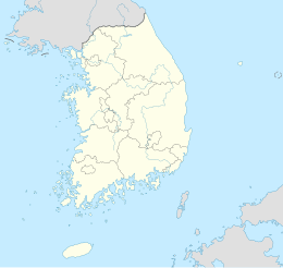
| Stato | |
| Provincia | Sud Gyeongsang |
| Territorio | |
| Coordinate | 35°30′N 128°45′E |
| Superficie | 799,03 km² |
| Abitanti | 112 602 (2006) |
| Densità | 140,92 ab./km² |
| Altre informazioni | |
| Fuso orario | UTC+9 |
| Cartografia | |
 Miryang | |
 | |
| Sito istituzionale | |
Clima
| Miryang (1981-2010) Fonte: 기상청[1] | Mesi | Stagioni | Anno | ||||||||||||||
|---|---|---|---|---|---|---|---|---|---|---|---|---|---|---|---|---|---|
| Gen | Feb | Mar | Apr | Mag | Giu | Lug | Ago | Set | Ott | Nov | Dic | Inv | Pri | Est | Aut | ||
| T. max. media (°C) | 7,4 | 9,9 | 14,7 | 20,7 | 25,5 | 28,3 | 30,4 | 31,3 | 27,4 | 22,6 | 15,9 | 9,3 | 8,9 | 20,3 | 30,0 | 22,0 | 20,3 |
| T. media (°C) | 0,5 | 2,8 | 7,7 | 13,2 | 18,3 | 22,3 | 25,6 | 26,1 | 21,5 | 15,2 | 8,4 | 2,1 | 1,8 | 13,1 | 24,7 | 15,0 | 13,6 |
| T. min. media (°C) | −5,4 | −3,6 | 0,9 | 6,0 | 11,6 | 17,3 | 21,8 | 22,0 | 16,6 | 9,0 | 2,1 | −3,6 | −4,2 | 6,2 | 20,4 | 9,2 | 7,9 |
| T. max. assoluta (°C) | 18,1 (2020) | 23,7 (2021) | 26,2 (1998) | 31,1 (2009) | 36,6 (2017) | 36,1 (2017) | 39,4 (1994) | 39,0 (2017) | 35,9 (2011) | 30,8 (2021) | 26,1 (1979) | 19,9 (1990) | 23,7 | 36,6 | 39,4 | 35,9 | 39,4 |
| T. min. assoluta (°C) | −15,8 (2011) | −15,6 (1984) | −10,4 (1977) | −3,9 (1978) | 1,0 (1976) | 7,4 (1992) | 13,4 (1989) | 12,9 (1993) | 5,3 (2008) | −2,7 (1984) | −8,1 (1979) | −14,5 (2005) | −15,8 | −10,4 | 7,4 | −8,1 | −15,8 |
| Giorni di calura (Tmax ≥ 30 °C) | 0,0 | 0,0 | 0,0 | 0,1 | 3,3 | 10,6 | 18,1 | 21,3 | 6,9 | 0,0 | 0,0 | 0,0 | 0,0 | 3,4 | 50,0 | 6,9 | 60,3 |
| Giorni di gelo (Tmin ≤ 0 °C) | 28,1 | 23,2 | 13,3 | 1,9 | 0,0 | 0,0 | 0,0 | 0,0 | 0,0 | 0,3 | 11,0 | 26,3 | 77,6 | 15,2 | 0,0 | 11,3 | 104,1 |
| Giorni di ghiaccio (Tmax ≤ 0 °C) | 0,6 | 0,2 | 0,0 | 0,0 | 0,0 | 0,0 | 0,0 | 0,0 | 0,0 | 0,0 | 0,0 | 0,1 | 0,9 | 0,0 | 0,0 | 0,0 | 0,9 |
| Precipitazioni (mm) | 21,2 | 33,0 | 59,0 | 90,5 | 106,7 | 155,9 | 259,3 | 240,6 | 144,4 | 53,3 | 40,1 | 22,6 | 76,8 | 256,2 | 655,8 | 237,8 | 1 226,6 |
| Giorni di pioggia | 3,9 | 4,7 | 6,8 | 8,2 | 8,6 | 9,5 | 13,5 | 12,8 | 8,7 | 4,3 | 5,1 | 4,0 | 12,6 | 23,6 | 35,8 | 18,1 | 90,1 |
| Umidità relativa media (%) | 58,9 | 56,7 | 58,3 | 59,7 | 64,0 | 69,5 | 77,3 | 76,7 | 74,7 | 71,1 | 68,0 | 61,8 | 59,1 | 60,7 | 74,5 | 71,3 | 66,4 |
| Ore di soleggiamento mensili | 188,0 | 184,6 | 208,2 | 214,2 | 225,9 | 175,5 | 151,5 | 172,7 | 160,6 | 197,4 | 174,4 | 183,9 | 556,5 | 648,3 | 499,7 | 532,4 | 2 236,9 |
| Pressione a 0 metri s.l.m. (hPa) | 1 023,7 | 1 022,3 | 1 019,2 | 1 015,3 | 1 011,7 | 1 008,2 | 1 007,6 | 1 009,1 | 1 013,7 | 1 019,1 | 1 022,3 | 1 024,2 | 1 023,4 | 1 015,4 | 1 008,3 | 1 018,4 | 1 016,4 |
| Tensione di vapore (hPa) | 3,8 | 4,4 | 6,0 | 8,9 | 12,9 | 18,3 | 25,1 | 25,6 | 19,0 | 12,1 | 7,6 | 4,5 | 4,2 | 9,3 | 23,0 | 12,9 | 12,4 |
| Vento (direzione-m/s) | 1,3 | 1,4 | 1,6 | 1,6 | 1,5 | 1,5 | 1,5 | 1,4 | 1,3 | 1,1 | 1,1 | 1,2 | 1,3 | 1,6 | 1,5 | 1,2 | 1,4 |
Note
Altri progetti
 Wikimedia Commons contiene immagini o altri file su Miryang
Collegamenti esterni
- (KO) Sito ufficiale, su miryang.go.kr.
- (EN) Sito ufficiale, su eng.miryang.go.kr.
- (ZH) Sito ufficiale, su chi.miryang.go.kr.
- (JA) Sito ufficiale, su jpn.miryang.go.kr.
На других языках
[en] Miryang
Miryang (perhaps pronounced as Milbeol using Idu script),[1][2] formerly also spelled as 推火郡 (probably pronounced as Milbeol or Miribeol using Idu script), Milbeol (密伐) and Milseong (密城),[3] is a city in Gyeongsangnam-do Province, South Korea. Its name is originated from the tribal country named Miri midong guk (彌離彌凍國).[4] There are various hypotheses as to the meaning of Miryang, such as Milky Way, Galaxy, dragon's field, The Wheat Field and the watery field.[1][2][5] Neighboring cities include Changnyeong to the west, Cheongdo to the north, Ulsan to the east, and Yangsan, Gimhae, and Changwon to the south. The city bird is the Korean magpie, the city tree is the pine, and the city flower is the royal azalea.- [it] Miryang
[ru] Мирян
Миря́н (кор. 밀양시?, 密陽市?, Miryang-si) — город в провинции Кёнсан-Намдо, Южная Корея.Текст в блоке "Читать" взят с сайта "Википедия" и доступен по лицензии Creative Commons Attribution-ShareAlike; в отдельных случаях могут действовать дополнительные условия.
Другой контент может иметь иную лицензию. Перед использованием материалов сайта WikiSort.org внимательно изучите правила лицензирования конкретных элементов наполнения сайта.
Другой контент может иметь иную лицензию. Перед использованием материалов сайта WikiSort.org внимательно изучите правила лицензирования конкретных элементов наполнения сайта.
2019-2026
WikiSort.org - проект по пересортировке и дополнению контента Википедии
WikiSort.org - проект по пересортировке и дополнению контента Википедии