world.wikisort.org - Corea_del_Sud
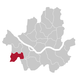
Guro (Hangŭl: 구로구; Hanja: 九老區) è un distretto di Seul. Ha una superficie di 20,11 km² e una popolazione di 417.339 abitanti al 2010.
|
Questa voce o sezione sull'argomento centri abitati della Corea del Sud non cita le fonti necessarie o quelle presenti sono insufficienti.
|
| Guro distretto | |
|---|---|
| Hangŭl: 구로구 Hanja: 九老區 | |
 | |
| Localizzazione | |
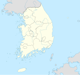
| Stato | |
| Provincia | Seul |
| Territorio | |
| Coordinate | 37°29′37″N 126°53′18″E |
| Superficie | 20,11 km² |
| Abitanti | 417 339 (2010) |
| Densità | 20 752,81 ab./km² |
| Città | 15 dong |
| Altre informazioni | |
| Fuso orario | UTC+9 |
| Cartografia | |
 Guro | |
 | |
| Sito istituzionale | |
Altri progetti
 Wikimedia Commons contiene immagini o altri file su Guro-gu
Collegamenti esterni
- Sito ufficiale, su english.guro.go.kr.
На других языках
[en] Guro District, Seoul
Guro District (Guro-gu) is a district of Seoul, South Korea, which was separated from Yeongdeungpo District on April 1, 1980. Located in the southwestern part of the city, where besides Yangcheon District and Geumcheon District Guro District has an important position as a transport link which contains railroads, land routes from the rest of Seoul to the south of the country. The Gyeongbu and Gyeongin railway lines connect Seoul to Busan and Incheon. In addition, Seoul Metropolitan Subway lines 1, 2, and 7, and major highways intersect in Guro District.- [it] Distretto di Guro (Corea del Sud)
Текст в блоке "Читать" взят с сайта "Википедия" и доступен по лицензии Creative Commons Attribution-ShareAlike; в отдельных случаях могут действовать дополнительные условия.
Другой контент может иметь иную лицензию. Перед использованием материалов сайта WikiSort.org внимательно изучите правила лицензирования конкретных элементов наполнения сайта.
Другой контент может иметь иную лицензию. Перед использованием материалов сайта WikiSort.org внимательно изучите правила лицензирования конкретных элементов наполнения сайта.
2019-2024
WikiSort.org - проект по пересортировке и дополнению контента Википедии
WikiSort.org - проект по пересортировке и дополнению контента Википедии