world.wikisort.org - Sudafrica
Napier è una cittadina sudafricana situata nella municipalità distrettuale di Overberg nella provincia del Capo Occidentale.
| Napier città | |
|---|---|
 | |
| Localizzazione | |
| Stato | |
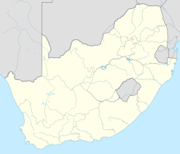
| Provincia | Capo Occidentale |
| Distretto | Overberg |
| Municipalità locale | Cape Agulhas |
| Territorio | |
| Coordinate | 34°28′S 19°54′E |
| Superficie | 23,04[1] km² |
| Abitanti | 4 214[2] (2011) |
| Densità | 182,9 ab./km² |
| Altre informazioni | |
| Cod. postale | 7270 e 7270 |
| Prefisso | 028 |
| Fuso orario | UTC+2 |
| Cartografia | |
 Napier | |
Geografia fisica
La cittadina sorge sulle rive del fiume Klipdrif.
Note
Altri progetti
 Wikimedia Commons contiene immagini o altri file su Napier (Sudafrica)
На других языках
[de] Napier (Südafrika)
Napier ist eine Kleinstadt in der Gemeinde Cape Agulhas, Distrikt Overberg, Provinz Westkap in Südafrika. Die Stadt liegt 16 Kilometer westlich von Bredasdorp und 58 Kilometer südöstlich von Caledon in 111 Meter Höhe über dem Meeresspiegel. 2011 hatte der Ort 4214 Einwohner.[1][en] Napier, South Africa
Napier is a village at the foot of the Soetmuisberg, between Caledon and Bredasdorp. A blend of century-old cottages and modern houses, surrounded by the rolling farmland which typifies the Overberg region of South Africa, give the village a rural atmosphere.- [it] Napier (Sudafrica)
Текст в блоке "Читать" взят с сайта "Википедия" и доступен по лицензии Creative Commons Attribution-ShareAlike; в отдельных случаях могут действовать дополнительные условия.
Другой контент может иметь иную лицензию. Перед использованием материалов сайта WikiSort.org внимательно изучите правила лицензирования конкретных элементов наполнения сайта.
Другой контент может иметь иную лицензию. Перед использованием материалов сайта WikiSort.org внимательно изучите правила лицензирования конкретных элементов наполнения сайта.
2019-2025
WikiSort.org - проект по пересортировке и дополнению контента Википедии
WikiSort.org - проект по пересортировке и дополнению контента Википедии