world.wikisort.org - Sudafrica
Maluti a Phofung è una municipalità locale (in inglese Maluti a Phofung Local Municipality) appartenente alla municipalità distrettuale di Thabo Mofutsanyane della provincia di Free State in Sudafrica. In base al censimento del 2001 la sua popolazione è di 360.786 abitanti.
| Municipalità locale di Maluti a Phofung municipalità locale | |
|---|---|
| Maluti a Phofung Local Municipality | |
| Localizzazione | |
| Stato | |
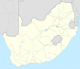
| Provincia | Free State |
| Distretto | Thabo Mofutsanyane |
| Amministrazione | |
| Capoluogo | Witsieshoek |
| Territorio | |
| Coordinate del capoluogo | 28°33′03.6″S 29°04′48″E |
| Altitudine | 1 706 m s.l.m. |
| Superficie | 4 417 km² |
| Abitanti | 360 786 (2001) |
| Densità | 81,68 ab./km² |
| Altre informazioni | |
| Fuso orario | UTC+2 |
| Cartografia | |
 Witsieshoek | |
 | |
La sede amministrativa e legislativa è la città di Witsieshoek e il suo territorio si estende su una superficie di 4.417 km² ed è suddiviso in 34 circoscrizioni elettorali (wards). Il suo codice di distretto è FS194.
Nel territorio di questa municipalità locale è situato anche un District Management Areas (DMAs) con codice FSDMA19.
Geografia fisica
Confini
La municipalità locale di Maluti a Phofung confina a nord con quella di Phumelela, a est con quelle di Emnambithi/Ladysmith e Okhahlamba (Uthukela/ KwaZulu-Natal), a sud con il Lesotho e a ovest con quella di Dihlabeng.
Città e comuni
- Bolata
- Harrismith
- Intanbazwe
- Kestell
- Mabolela
- Matsieng
- Monontsha
- Namahadi
- Phomolong
- Phuthaditjhaba
- Thaba Bosiu
- Thaba Tshweu
- Thibela
- Tlholong
- Tshiame
- Witsieshoek
- 42nd Hill
Fiumi
- Caledon
- Dwaalspruit
- Elands
- Frasers Spruit
- Kgotjwane
- Klerkspruit
- Little Caledon
- Meul
- Metsimatsho
- Modderspruit
- Mpandweni
- Namahadi
- Nuwejaarspruit
- Pleasant Gift
- Ribbokspruit
- Rietspruit
- Sekoto
- Tierkloof
- Vaalbankspruit
- Wilge
Dighe
- Driekloofdam
- Gibson Dam
- Metsimetshodam
- Platberg Dam
- Sterkfonteindam
- Witsieshoek Mountain Reso
Collegamenti esterni
- Municipal Demarcation Board, su demarcation.org.za. URL consultato il 25 febbraio 2009 (archiviato dall'url originale il 26 aprile 2009).
На других языках
[de] Maluti-a-Phofung
Maluti-A-Phofung (englisch Maluti-A-Phofung Local Municipality) ist eine Lokalgemeinde im Distrikt Thabo Mofutsanyana, Provinz Freistaat, Südafrika. Der Verwaltungssitz befindet sich in Phuthaditjhaba. Bürgermeisterin ist Mamotsheare Maria Lakaje-Mosia.[1][en] Maluti-a-Phofung Local Municipality
Maluti-a-Phofung Local Municipality is an administrative area in the Thabo Mofutsanyane District of the Free State in South Africa. It encompasses substantially all of the former bantustan of QwaQwa, except for the small enclave (detached portion) at Botshabelo.[3][4] The population is almost entirely Southern Sotho.[4] The municipality is named after the Drakensberg mountains (known as "Maluti" in Sesotho). The peak in QwaQwa is known as the Sentinel, which is called "Phofung" in Sesotho.[5]- [it] Municipalità locale di Maluti a Phofung
Другой контент может иметь иную лицензию. Перед использованием материалов сайта WikiSort.org внимательно изучите правила лицензирования конкретных элементов наполнения сайта.
WikiSort.org - проект по пересортировке и дополнению контента Википедии