world.wikisort.org - Sudafrica
Matjiesrivier è un centro abitato sudafricano situato nella municipalità distrettuale di Eden nella provincia del Capo Occidentale.
| Matjiesrivier città | |
|---|---|
| Localizzazione | |
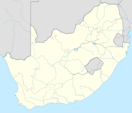
| Stato | |
| Provincia | Capo Occidentale |
| Distretto | Eden |
| Municipalità locale | Oudtshoorn |
| Territorio | |
| Coordinate | 33°23′56.4″S 22°02′06″E |
| Abitanti | |
| Altre informazioni | |
| Cod. postale | 6634 |
| Prefisso | 044 |
| Fuso orario | UTC+2 |
| Cartografia | |
 Matjiesrivier | |
Il nome significa, in lingua afrikaans, "fiume delle stuoie", in riferimento a una specie di ciperacee che qui cresce in abbondanza e dalla quale i nativi khoikhoi ricavavano delle stuoie con le quali realizzavano le loro capanne.[1]
Geografia fisica
Il piccolo centro abitato sorge ai peidi dei monti Waboomsberg a circa 25 chilometri a nord-est della cittadina di Oudtshoorn.
Note
- RE Raper - HSRC, Dictionary of Southern African Place Names. URL consultato il 9 marzo 2020.
На других языках
[en] Matjiesrivier
Matjiesrivier is a town at the southern foot of the Waboomsberg, some 37 km south of Prince Albert, off the road to Oudtshoorn. Afrikaans for 'mat river', the reference is to a type of sedge (Cyperus textilis) growing there, used by Khoekhoen in making mats with which they made their huts. Matjiesgoed is the common name for this sedge, literally 'mat stuff.[1]- [it] Matjiesrivier
Текст в блоке "Читать" взят с сайта "Википедия" и доступен по лицензии Creative Commons Attribution-ShareAlike; в отдельных случаях могут действовать дополнительные условия.
Другой контент может иметь иную лицензию. Перед использованием материалов сайта WikiSort.org внимательно изучите правила лицензирования конкретных элементов наполнения сайта.
Другой контент может иметь иную лицензию. Перед использованием материалов сайта WikiSort.org внимательно изучите правила лицензирования конкретных элементов наполнения сайта.
2019-2025
WikiSort.org - проект по пересортировке и дополнению контента Википедии
WikiSort.org - проект по пересортировке и дополнению контента Википедии