world.wikisort.org - Sudafrica
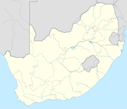
Kathu è un centro abitato del Sudafrica, situato nella provincia del Capo Settentrionale.
| Kathu città | |
|---|---|
| Localizzazione | |
| Stato | |
| Provincia | Capo Settentrionale |
| Distretto | John Taolo Gaetsewe |
| Municipalità locale | Gamagara |
| Territorio | |
| Coordinate | 27°42′S 23°03′E |
| Altitudine | 1 233 m s.l.m. |
| Superficie | 15,56 km² |
| Abitanti | 11 510 (2011) |
| Densità | 739,72 ab./km² |
| Altre informazioni | |
| Cod. postale | 8446 e 8446 |
| Prefisso | 053 |
| Fuso orario | UTC+2 |
| Cartografia | |
Altri progetti
 Wikimedia Commons contiene immagini o altri file su Kathu
| Controllo di autorità | VIAF (EN) 151670751 · LCCN (EN) no2009076060 |
|---|
На других языках
[de] Kathu (Südafrika)
Kathu ist eine Stadt in der Gemeinde Gamagara, Distrikt John Taolo Gaetsewe, Provinz Nordkap in Südafrika. Sie liegt in einer Höhe von 1230 Meter über dem Meeresspiegel und hatte 2011 11.510 Einwohner.[1][en] Kathu
Kathu is a town in South Africa, and the iron ore capital of the Northern Cape province. Its name means "town under the trees", after the Camel Thorn forest it is situated in. The phrase "the town under the trees" was coined by an engineer working in the town in the early-1990s as part of a tourist marketing drive, together with the accompanying graphic. It was intended to be a marketing slogan. The meaning of the word "Kathu" has anecdotically been attributed to a porridge brewed by the local population from the powder found in the pods of the Camel Thorn trees.- [it] Kathu
Текст в блоке "Читать" взят с сайта "Википедия" и доступен по лицензии Creative Commons Attribution-ShareAlike; в отдельных случаях могут действовать дополнительные условия.
Другой контент может иметь иную лицензию. Перед использованием материалов сайта WikiSort.org внимательно изучите правила лицензирования конкретных элементов наполнения сайта.
Другой контент может иметь иную лицензию. Перед использованием материалов сайта WikiSort.org внимательно изучите правила лицензирования конкретных элементов наполнения сайта.
2019-2025
WikiSort.org - проект по пересортировке и дополнению контента Википедии
WikiSort.org - проект по пересортировке и дополнению контента Википедии
