world.wikisort.org - Sudafrica
Carletonville è un centro abitato del Sudafrica, situato nella provincia del Gauteng.
| Carletonville città | |
|---|---|
| Localizzazione | |
| Stato | |
| Provincia | Gauteng |
| Distretto | West Rand |
| Municipalità locale | Merafong City |
| Territorio | |
| Coordinate | 26°21′29″S 27°23′53″E |
| Altitudine | 1 529 m s.l.m. |
| Superficie | 35,14 km² |
| Abitanti | 23 000 (2011) |
| Densità | 654,52 ab./km² |
| Altre informazioni | |
| Cod. postale | 2499 e 2500 |
| Prefisso | 018 |
| Fuso orario | UTC+2 |
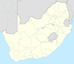
| Cartografia | |
Altri progetti
 Wikimedia Commons contiene immagini o altri file su Carletonville
Collegamenti esterni
- (EN) Carletonville, su Enciclopedia Britannica, Encyclopædia Britannica, Inc.
| Controllo di autorità | VIAF (EN) 141550650 · WorldCat Identities (EN) viaf-141550650 |
|---|
На других языках
[de] Carletonville
Carletonville ist eine vom Goldbergbau geprägte Stadt, etwa 50 Kilometer südwestlich von Johannesburg, zwischen den Höhenzügen Gatsrand im Süden und Witwatersrand im Norden sowie an der Kreuzung der Regionalstraßen R500 und R501. Im Jahre 2011 hatte sie 23.000 Einwohner.[1][en] Carletonville
Carletonville is a town in Gauteng and the seat of the Merafong City Local Municipality in the West Rand District Municipality in Gauteng, South Africa, just north of the richest gold-mining area in the world. At 3,749 m, Western Deep Levels holds the record for the world's deepest gold mine.- [it] Carletonville
[ru] Карлтонвилл
Карлтонвилл[3] (Carletonville) — город в местном муниципалитетм Мерафонг-Сити в районе Уэст-Ранд провинции Гаутенг (ЮАР).Текст в блоке "Читать" взят с сайта "Википедия" и доступен по лицензии Creative Commons Attribution-ShareAlike; в отдельных случаях могут действовать дополнительные условия.
Другой контент может иметь иную лицензию. Перед использованием материалов сайта WikiSort.org внимательно изучите правила лицензирования конкретных элементов наполнения сайта.
Другой контент может иметь иную лицензию. Перед использованием материалов сайта WikiSort.org внимательно изучите правила лицензирования конкретных элементов наполнения сайта.
2019-2025
WikiSort.org - проект по пересортировке и дополнению контента Википедии
WikiSort.org - проект по пересортировке и дополнению контента Википедии
