world.wikisort.org - Sudafrica
Bothaville è un centro abitato del Sudafrica, situato nella provincia del Free State.
| Bothaville città | |
|---|---|
 | |
| Localizzazione | |
| Stato | |
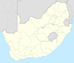
| Provincia | Free State |
| Distretto | Lejweleputswa |
| Municipalità locale | Nala |
| Territorio | |
| Coordinate | 27°23′S 26°37′E |
| Altitudine | 1 276 m s.l.m. |
| Superficie | 43 km² |
| Abitanti | 46 030 (2011) |
| Densità | 1 070,47 ab./km² |
| Altre informazioni | |
| Cod. postale | 9660 |
| Prefisso | 056 |
| Fuso orario | UTC+2 |
| Cartografia | |
 Bothaville | |
Collegamenti esterni
- (EN) Sito web, su bothaville.info.
| Controllo di autorità | VIAF (EN) 138524641 · LCCN (EN) n93058600 · WorldCat Identities (EN) lccn-n93058600 |
|---|
На других языках
[de] Bothaville
Bothaville ist eine Stadt in der südafrikanischen Provinz Freistaat (Free State). Sie ist Sitz der Gemeinde Nala im Distrikt Lejweleputswa.[en] Bothaville
Bothaville is a maize farming town situated near the Vaal River in the Lejweleputswa DM of the Free State province, South Africa. It is situated 60 km east of the Vaal, on the bank of its Vals River tributary. Bothaville and the adjacent Kgotsong township have a total of approximately 46,000 residents.[2]- [it] Bothaville
Текст в блоке "Читать" взят с сайта "Википедия" и доступен по лицензии Creative Commons Attribution-ShareAlike; в отдельных случаях могут действовать дополнительные условия.
Другой контент может иметь иную лицензию. Перед использованием материалов сайта WikiSort.org внимательно изучите правила лицензирования конкретных элементов наполнения сайта.
Другой контент может иметь иную лицензию. Перед использованием материалов сайта WikiSort.org внимательно изучите правила лицензирования конкретных элементов наполнения сайта.
2019-2025
WikiSort.org - проект по пересортировке и дополнению контента Википедии
WikiSort.org - проект по пересортировке и дополнению контента Википедии