world.wikisort.org - Slovenia
Zlatoličje (pronounced [zlatɔˈliːtʃjɛ]) is a village on the right bank of the Drava River southeast of Maribor in northeastern Slovenia. It lies in the Municipality of Starše in an area that is part of the traditional region of Styria. The municipality is now included in the Drava Statistical Region.[2] South of the settlement is a hydroelectric power plant, opened in 1969.
Zlatoličje | |
|---|---|
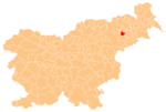
 Zlatoličje Location in Slovenia | |
| Coordinates: 46°27′22.36″N 15°47′24.3″E | |
| Country | |
| Traditional region | Styria |
| Statistical region | Drava |
| Municipality | Starše |
| Area | |
| • Total | 7.1 km2 (2.7 sq mi) |
| Elevation | 237 m (778 ft) |
| Population (2002) | |
| • Total | 744 |
| [1] | |
Name
Zlatoličje was attested in written sources in 1220–30 and later as Goldarn (and as Goldsdorf in 1320). The Slovene name is derived from the common noun zlatolika 'golden willow' (Salix alba var. vitellina), referring to local vegetation. A less likely derivation is from Slavic *zoltolykъ 'gold seeker'.[3]
Cultural heritage
The village chapel with a small belfry was built in 1900.[4]
References
- Statistical Office of the Republic of Slovenia Archived November 18, 2008, at the Wayback Machine
- Starše municipal site
- Snoj, Marko. 2009. Etimološki slovar slovenskih zemljepisnih imen. Ljubljana: Modrijan and Založba ZRC, p. 482.
- Slovenian Ministry of Culture register of national heritage Archived July 12, 2010, at the Wayback Machine reference number ešd 20312
External links
- Zlatoličje on Geopedia
 Media related to Zlatoličje at Wikimedia Commons
Municipality of Starše | ||
|---|---|---|
| Settlements | Administrative seat: Starše
|  |
This article about the Municipality of Starše in Slovenia is a stub. You can help Wikipedia by expanding it. |
Другой контент может иметь иную лицензию. Перед использованием материалов сайта WikiSort.org внимательно изучите правила лицензирования конкретных элементов наполнения сайта.
WikiSort.org - проект по пересортировке и дополнению контента Википедии