world.wikisort.org - Slovakia
Hnojné (Hungarian: Hanajna) is a village and municipality in Michalovce District in the Kosice Region of eastern Slovakia.
Hnojné | |
|---|---|
Municipality | |
 | |
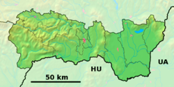 Hnojné Location of Hnojné in the Košice Region  Hnojné Location of Hnojné in Slovakia | |
| Coordinates: 48°47′0″N 22°4′0″E | |
| Country | |
| Region | Košice |
| District | Michalovce |
| First mentioned | 1390 |
| Area | |
| • Total | 6.81[1] km2 (2.63[1] sq mi) |
| Elevation | 108[2] m (354[2] ft) |
| Population (2021) | |
| • Total | 244[3] |
| Time zone | UTC+1 (CET) |
| • Summer (DST) | UTC+2 (CEST) |
| Postal code | 072 33[2] |
| Area code | +421 56[2] |
| Car plate | MI |
| Website | www |
History
In historical records the village was first mentioned in 1390.
Geography
The village lies at an altitude of 108 metres and covers an area of 6.811 km². It has a population of about 250 people.
Ethnicity
The population is about 99% Slovak in ethnicity.
Culture
The village has a small public library and food stores.
Transport
The nearest railway station is 17 kilometres away at Michalovce.
Genealogical resources
The records for genealogical research are available at the state archive "Statny Archiv in Presov, Slovakia"
- Greek Catholic church records (births/marriages/deaths): 1805-1937 (parish B)
Gallery
 Church of the Transfiguration of the Lord in Hnojné
 Church of the Transfiguration of the Lord in Hnojné

See also
- List of municipalities and towns in Slovakia
References
- "Hustota obyvateľstva - obce [om7014rr_ukaz: Rozloha (Štvorcový meter)]". www.statistics.sk (in Slovak). Statistical Office of the Slovak Republic. 2022-03-31. Retrieved 2022-03-31.
- "Základná charakteristika". www.statistics.sk (in Slovak). Statistical Office of the Slovak Republic. 2015-04-17. Retrieved 2022-03-31.
- "Počet obyvateľov podľa pohlavia - obce (ročne)". www.statistics.sk (in Slovak). Statistical Office of the Slovak Republic. 2022-03-31. Retrieved 2022-03-31.
External links
Wikimedia Commons has media related to Hnojné.
- Official website

- https://web.archive.org/web/20071116010355/http://www.statistics.sk/mosmis/eng/run.html
- Surnames of living people in Hnojne
Municipalities of Michalovce District | ||
|---|---|---|
| ||
This Michalovce District geography article is a stub. You can help Wikipedia by expanding it. |
На других языках
[de] Hnojné
Hnojné (ungarisch Hanajna)[1] ist eine Gemeinde im Osten der Slowakei mit 219 Einwohnern (Stand 31. Dezember 2020), die zum Okres Michalovce, einem Teil des Košický kraj, gehört und in der traditionellen Landschaft Zemplín liegt.- [en] Hnojné
Текст в блоке "Читать" взят с сайта "Википедия" и доступен по лицензии Creative Commons Attribution-ShareAlike; в отдельных случаях могут действовать дополнительные условия.
Другой контент может иметь иную лицензию. Перед использованием материалов сайта WikiSort.org внимательно изучите правила лицензирования конкретных элементов наполнения сайта.
Другой контент может иметь иную лицензию. Перед использованием материалов сайта WikiSort.org внимательно изучите правила лицензирования конкретных элементов наполнения сайта.
2019-2025
WikiSort.org - проект по пересортировке и дополнению контента Википедии
WikiSort.org - проект по пересортировке и дополнению контента Википедии