world.wikisort.org - Slovakia
Ždiar (former name Žjár) is a village and municipality in the Poprad District in the Prešov Region in Spiš in northern Slovakia.
Ždiar | |
|---|---|
Municipality | |
 | |
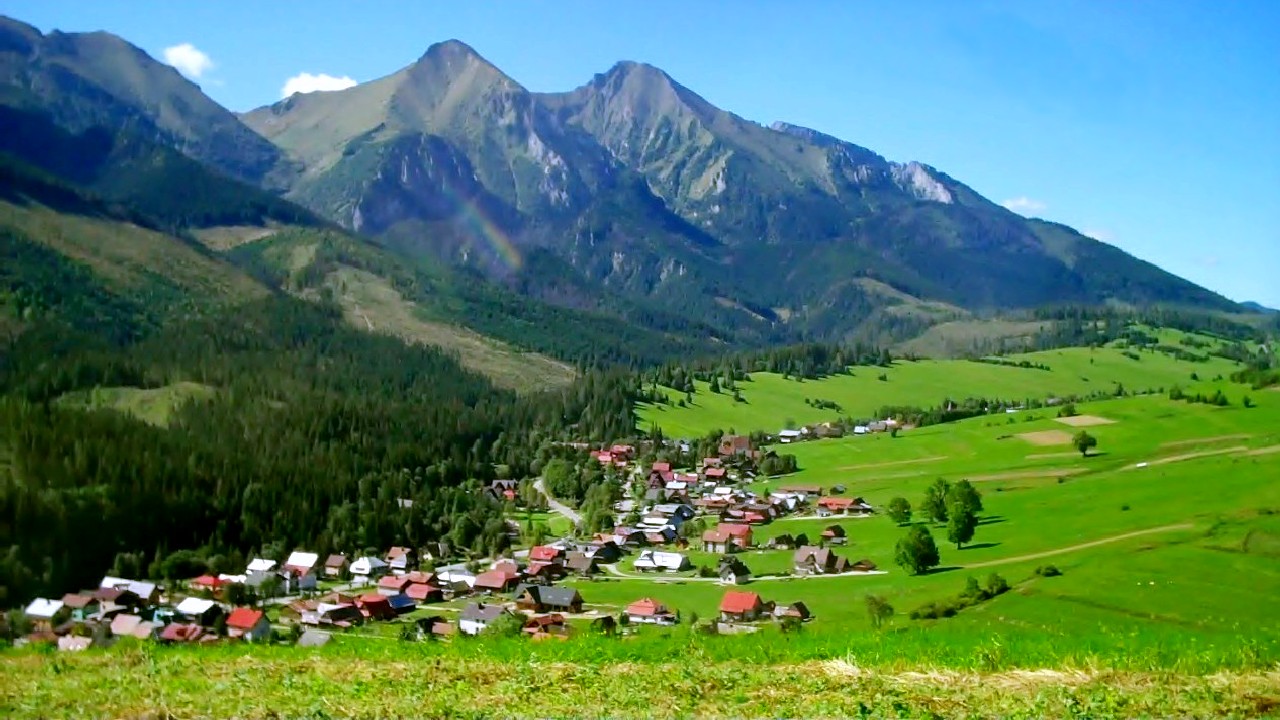
 Ždiar Location of Ždiar in Slovakia | |
| Coordinates: 49°16′15″N 20°15′55″E | |
| Country | Slovakia |
| Region | Prešov |
| District | Poprad |
| Area | |
| • Total | 27.23[1] km2 (10.51[1] sq mi) |
| Elevation | 895[2] m (2,936[2] ft) |
| Population (2021) | |
| • Total | 1,368[3] |
| Postal code | 059 55[2] |
| Area code | +421 52[2] |
| Car plate | PP |
| Website | www.zdiar.sk |
History
In historical records the village was first mentioned in 1409. Its first name had been Stragan. Locals had been engaged in agriculture, pasturage and charcoal production. From the end of 19th century they began to be employed in tourism. It is a historically Goral village.
Geography
The municipality lies at an elevation of 896 meters at the base of the High Tatras and covers an area of 27.323 km². It has a population of about 1,340 people.
The village is located about 3 km from the Polish border crossing and 34 km from Poprad.
Recreation
Ždiar is located at the base of Strednica alpine and cross country Ski resort. Several hiking trails into the High Tatras begin in the village.
References
- "Hustota obyvateľstva - obce [om7014rr_ukaz: Rozloha (Štvorcový meter)]". www.statistics.sk (in Slovak). Statistical Office of the Slovak Republic. 2022-03-31. Retrieved 2022-03-31.
- "Základná charakteristika". www.statistics.sk (in Slovak). Statistical Office of the Slovak Republic. 2015-04-17. Retrieved 2022-03-31.
- "Počet obyvateľov podľa pohlavia - obce (ročne)". www.statistics.sk (in Slovak). Statistical Office of the Slovak Republic. 2022-03-31. Retrieved 2022-03-31.
External links
Municipalities of Poprad District | ||
|---|---|---|
Authority control | |
|---|---|
| General |
|
| National libraries | |
This Prešov Region geography article is a stub. You can help Wikipedia by expanding it. |
На других языках
[de] Ždiar
Ždiar (deutsch Morgenröthe, ungarisch Zár – bis 1902 Zsdjár, polnisch Ździar) ist eine fünf Kilometer lange Gemeinde in der Ostslowakei, nordöstlich der Hohen Tatra in der Nähe der polnischen Grenze gelegen.- [en] Ždiar
Другой контент может иметь иную лицензию. Перед использованием материалов сайта WikiSort.org внимательно изучите правила лицензирования конкретных элементов наполнения сайта.
WikiSort.org - проект по пересортировке и дополнению контента Википедии