world.wikisort.org - Russia
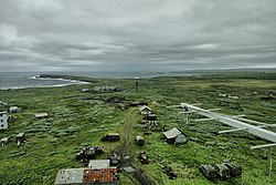
Tsypnavolok or Tsyp-Navolok (Russian: Цыпнаволок, Цып-Наволок) is a rural locality (an inhabited locality) in Pechengsky District of Murmansk Oblast, Russia, located on the Rybachy Peninsula by Cape Tsypnavolok, by the Barents Sea.
Tsypnavolok
Цыпнаволок | |
|---|---|
Inhabited locality | |
 Cape Tsypnavolok | |
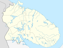
Location of Tsypnavolok  | |
 Tsypnavolok Location of Tsypnavolok  Tsypnavolok Tsypnavolok (Murmansk Oblast) | |
| Coordinates: 69°43′04″N 33°05′31″E | |
| Country | Russia |
| Federal subject | Murmansk Oblast |
| Founded | 1867 |
| Population | |
| • Total | 35 |
| Time zone | UTC+3 (MSK |
| Postal code(s)[3] | 184411 |
| Dialing code(s) | +7 81544 |
| OKTMO ID | 47615162116 |
History
During the 1860s, the Murmansk coast of the Kola Peninsula was actively being settled.[4] In 1867, a fishing village was established near Cape Tsypnavolok by Kola Norwegians (immigrants from Norway). In 1929, 114 ethnic Norwegians were registered in the area, and therefore in 1930 an ethnic Norwegian rural council (selsoviet) was established. In 1940, the Norwegians were transferred during the ethnic cleansing campaigns near the border, and the selsoviet was abolished.
After World War II, the Norwegians were allowed to return to Murmansk Oblast, but they were to be settled in Port-Vladimir (69°24′55.1″N 33°7′6.4″E) on Shalim Island in Kolsky District. (A naval base was later established there, civilians were evacuated in 1969 (the village was legally dissolved in 2008), and the base was closed and abandoned around 1994.)[citation needed]
Modern times
As of 2009, Tsypnavolok hosted a military unit, a weather station, and a lighthouse.
Accumulations of sulfide (chalcopyrite, galena, pyrite, sphalerite) nodules in turbidites are found in the area.[5]
References
Notes
- Статистический сборник Численность, размещение и возрастно-половой состав населения Мурманской области. Итоги Всероссийской переписи населения. Том 1. 2012 Archived 2012-12-22 at the Wayback Machine / Федеральная служба государственной статистики, Территориальный орган Федеральной службы государственной статистики по Мурманской области. Мурманск, 2012 — 75 с.
- "Об исчислении времени". Официальный интернет-портал правовой информации (in Russian). 3 June 2011. Retrieved 19 January 2019.
- Почта России. Информационно-вычислительный центр ОАСУ РПО. (Russian Post). Поиск объектов почтовой связи (Postal Objects Search) (in Russian)
- Administrative-Territorial Division of Murmansk Oblast, p. 23
- Mindat.org. Cape Tsypnavolok
Sources
- Архивный отдел Администрации Мурманской области. Государственный Архив Мурманской области. (1995). Административно-территориальное деление Мурманской области (1920-1993 гг.). Справочник. Мурманск: Мурманское издательско-полиграфическое предприятие "Север".
На других языках
- [en] Tsypnavolok
[ru] Цыпнаволок
Цыпнаволок (сев.‑саам. Sabbenjárga, Саббенйарга; фин. Tsipniemi, Ципниэми) — село в Печенгском районе Мурманской области. Расположено на полуострове Рыбачий, на берегу Баренцева моря.Другой контент может иметь иную лицензию. Перед использованием материалов сайта WikiSort.org внимательно изучите правила лицензирования конкретных элементов наполнения сайта.
WikiSort.org - проект по пересортировке и дополнению контента Википедии