world.wikisort.org - Russia
Tashanta (Russian: Ташанта) is a rural locality (a selo) and the administrative centre of Tashantinskoye Rural Settlement of Kosh-Agachsky District, the Altai Republic, Russia. The population was 547 as of 2016.[2] There are 13 streets.
Tashanta
Ташанта | |
|---|---|
Village | |
 | |
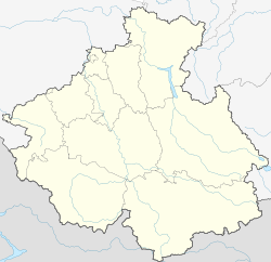 Tashanta  Tashanta | |
| Coordinates: 49°42′N 89°11′E[1] | |
| Country | Russia |
| Region | Altai Republic |
| District | Kosh-Agachsky District |
| Time zone | UTC+7:00 |
Geography
Tashanta is located on the bank of the river Tashantinki near the Russian border with Mongolia, 51 km southeast of Kosh-Agach (the district's administrative centre) by road. Zhana-Aul is the nearest rural locality.[3]
References
Rural localities in Kosh-Agachsky District | ||
|---|---|---|
This Altai Republic location article is a stub. You can help Wikipedia by expanding it. |
На других языках
[de] Taschanta
Taschanta (russisch Ташанта) ist ein Gebirgsdorf im russischen Teil des Altai, nahe der Grenze zur Mongolei. Es liegt auf einer Hochebene im Quellgebiet der Tschuja-Flusses, eines Zuflusses des Katun, unterhalb des Passes Durbet Daba (2482 m), und gehört zum Rajon Kosch-Agatsch.- [en] Tashanta, Altai Republic
[ru] Ташанта
Ташанта́ — село на юго-востоке Республики Алтай России, в Кош-Агачском районе. Административный центр Ташантинского сельского поселения.Текст в блоке "Читать" взят с сайта "Википедия" и доступен по лицензии Creative Commons Attribution-ShareAlike; в отдельных случаях могут действовать дополнительные условия.
Другой контент может иметь иную лицензию. Перед использованием материалов сайта WikiSort.org внимательно изучите правила лицензирования конкретных элементов наполнения сайта.
Другой контент может иметь иную лицензию. Перед использованием материалов сайта WikiSort.org внимательно изучите правила лицензирования конкретных элементов наполнения сайта.
2019-2025
WikiSort.org - проект по пересортировке и дополнению контента Википедии
WikiSort.org - проект по пересортировке и дополнению контента Википедии