world.wikisort.org - Russia
Krakolye (Russian: Кракóлье; Votic: Jõgõperä; Finnish: Joenperä; Ingrian: Joemperä) was a rural locality (a village) in Ust-Luzhsky Selsoviet of Kingiseppsky District in Leningrad Oblast, Russia, located just south of Ust-Luga and about 8 kilometers (5.0 mi) southwest of the Ust-Luga Harbour. It is now a part of the settlement of Ust-Luga.[1] Population: 110 (2007 est.).[2]
Krakolye
Краколье | |
|---|---|
Village (abolished) | |
 Map. 1860 year | |
Location of Krakolye  | |
 Krakolye Location of Krakolye 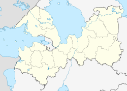 Krakolye Krakolye (Leningrad Oblast) | |
| Coordinates: 59°39′N 28°17′E | |
| Country | Russia |
| Federal subject | Leningrad Oblast |
| Administrative district | Kingiseppsky District |
| Selsoviet | Ust-Luzhsky Selsoviet |
| First mentioned | 1654 |
| Abolished | October 24, 2008[1] |
| Elevation | 13 m (43 ft) |
| Population | |
| • Estimate (2007)[2] | 110 |

History
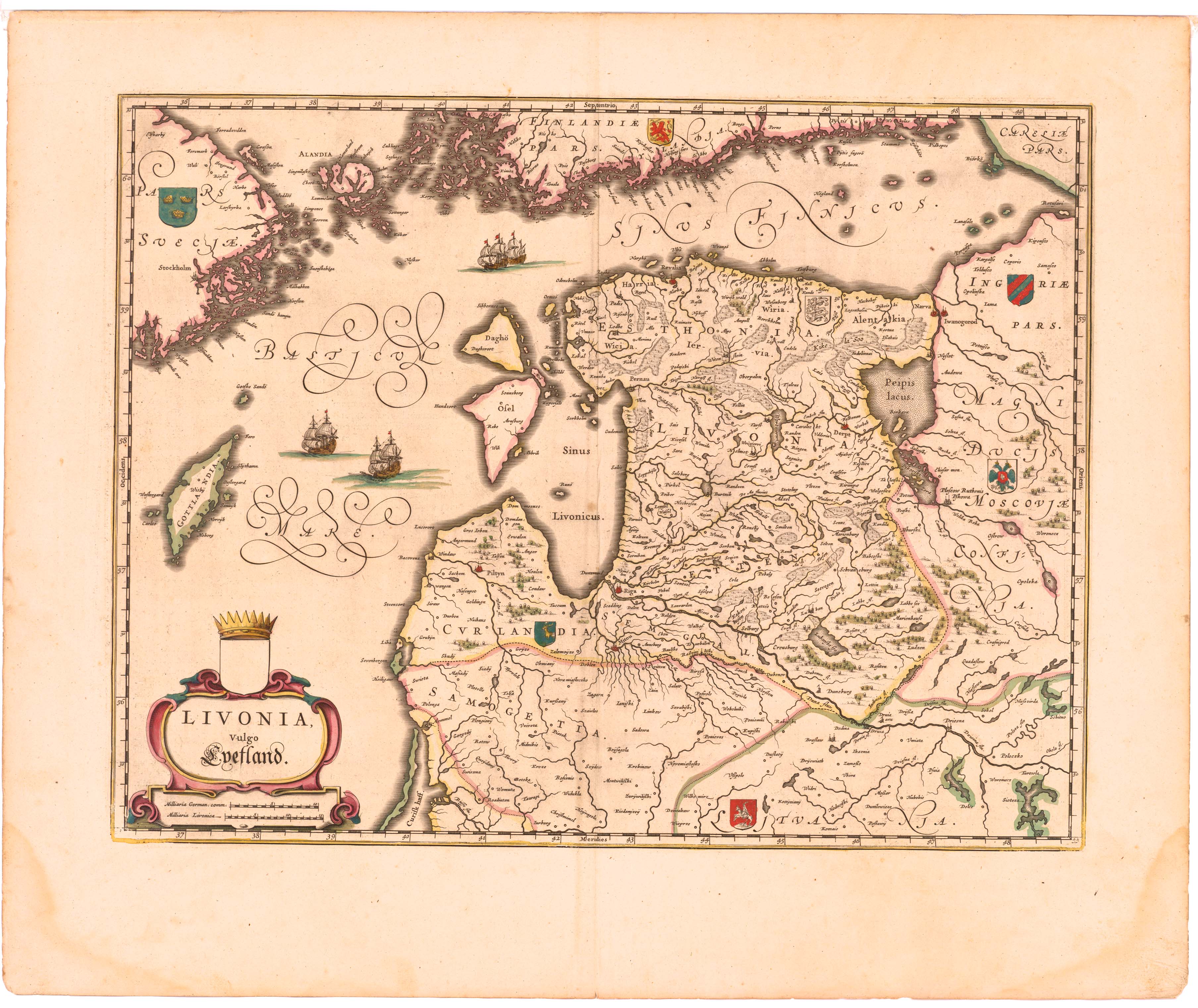
Krakolye was first mentioned in the Joan Blaeu's Livonian Atlas in 1654 as Kargalse.[3] It was one of the two villages where the Votic language was still spoken; the other was Luzhitsy in the Leningrad Oblast.
The village was merged into Ust-Luga effective October 24, 2008.[1]
Notable people
Votic teacher and linguist Dmitri Tsvetkov (1890–1930) was born in Krakolye.
References
- Законодательное Собрание Ленинградской области. Областной закон №98-оз от 13 октября 2008 г. «Об объединении посёлка Усть-Луга, деревни Краколье и посёлка при железнодорожной станции Усть-Луга Кингисеппского муниципального района Ленинградской области». Вступил в силу со дня официального опубликования. Опубликован: "Вести", №203, 24 октября 2008 г. (Legislative Assembly of Leningrad Oblast. Oblast Law #98-oz of October 13, 2008 On the Merger of the Settlement of Ust-Luga, the Village of Krakolye, and the Settlement at the Railway Station of Ust-Luga in Kingiseppsky Municipal District of Leningrad Oblst. Effective as of the day of the official publication.).
- "Административно-территориальное деление Ленинградской области". — СПб., 2007, с. 97.
- Карта Ливонии из большого атласа Блау. 1654 г.
Текст в блоке "Читать" взят с сайта "Википедия" и доступен по лицензии Creative Commons Attribution-ShareAlike; в отдельных случаях могут действовать дополнительные условия.
Другой контент может иметь иную лицензию. Перед использованием материалов сайта WikiSort.org внимательно изучите правила лицензирования конкретных элементов наполнения сайта.
Другой контент может иметь иную лицензию. Перед использованием материалов сайта WikiSort.org внимательно изучите правила лицензирования конкретных элементов наполнения сайта.
2019-2025
WikiSort.org - проект по пересортировке и дополнению контента Википедии
WikiSort.org - проект по пересортировке и дополнению контента Википедии