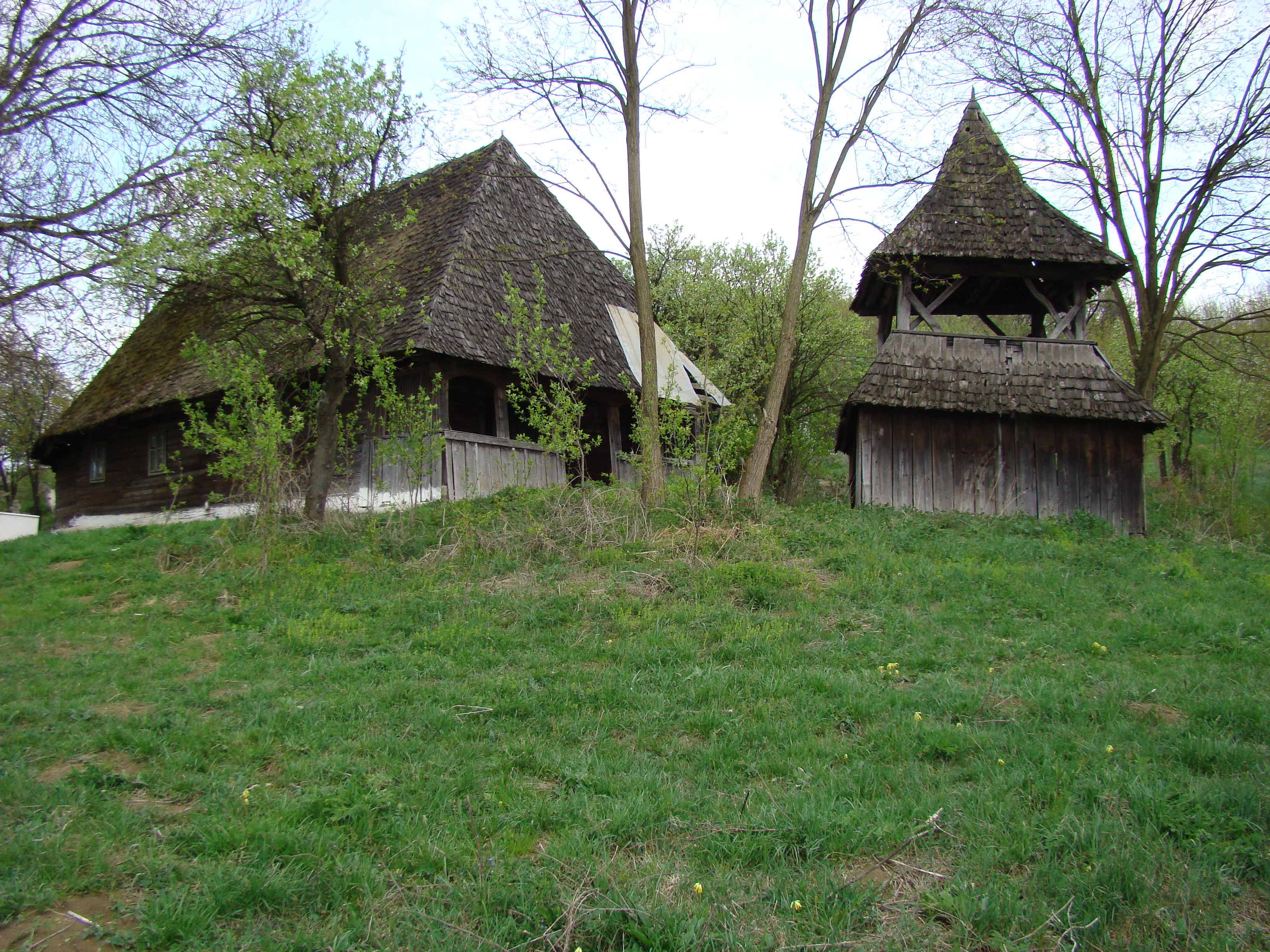
 Wooden church in Șpălnaca
 Wooden church in Turdaș
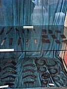 Dacian bracelets and other artifacts at the Aiud History Museum
world.wikisort.org - Romania
Hopârta (German: Meerport; Hungarian: Háporton) is a commune located in Alba County, Transylvania, Romania. It has a population of 1,152 (2011). It is composed of five villages: Hopârta, Silivaș (Mikószilvás), Șpălnaca (Ispánlaka), Turdaș (Oláhtordos), and Vama Seacă (Szárazvámtanya).
Hopârta | |
|---|---|
Commune | |
 View of Hopârta | |
 Location in Alba County | |
 Hopârta Location in Romania | |
| Coordinates: 46°19′15″N 23°52′14″E | |
| Country | Romania |
| County | Alba |
| Government | |
| • Mayor (2020–2024) | Augustin Popa (PNL) |
| Area | 61.48 km2 (23.74 sq mi) |
| Elevation | 375 m (1,230 ft) |
| Population (2011)[1] | 1,152 |
| • Density | 19/km2 (49/sq mi) |
| Time zone | EET/EEST (UTC+2/+3) |
| Postal code | 517335 |
| Vehicle reg. | AB |
| Website | www |
Geography
The commune is situated on the Transylvanian Plateau, in the northeastern corner of the county. The river Fărău flows north through Vama Seacă, discharging into the Mureș near Noșlac.
Hopârta has the following neighbors: the town of Ocna Mureș to the west and northwest, Noșlac commune to the northeast, Fărău and Șona communes to the east, and Lopadea Nouă commune to the south and southeast. It is traversed by county road DJ107E, which connects the city of Aiud, 16 kilometres (10 mi) to the west, to Vama Seacă, and then on via DJ107D, to Ocna Mureș. is traversed by county road DJ107E, which connects the city of Aiud, 16 kilometres (10 mi) to the west, to Vama Seacă, and then on via DJ107D, to Ocna Mureș.
Dacian bracelets from Șpălnaca

A trove of Dacian bracelets dating from the Bronze Age IV and Iron Age I (10th–9th centuries BC) have been discovered at Șpălnaca.[2] The bracelets have decorations of geometric characters of chiseled or engraved lines.[3]
Natives
- Ioan Andone (born 1960), footballer
- Virgil Gligor (1918–1977), veterinarian, corresponding member of the Romanian Academy
References
- "Populaţia stabilă pe judeţe, municipii, oraşe şi localităti componenete la RPL_2011" (XLS). National Institute of Statistics.
- Coles, John M.; Harding, Anthony F. (1979). The Bronze Age in Europe: an introduction to the prehistory of Europe, c. 2000–700 BC. London: Methuen. p. 409. ISBN 0-416-70640-1. OCLC 5005830.
- Pârvan, Vasile (1928). Dacia: an outline of the early civilizations of the Carpatho-Danubian countries. Cambridge, UK: Cambridge University Press. p. 12. OCLC 1000997262.
External links
- Pintilie, Dorin; Pintilie, Mariana; Dura, Nicolae V. (2003). Comuna Hopîrta: studiu monografic (in Romanian). Cluj-Napoca: Eurodidact. ISBN 973-86147-5-9. OCLC 895739284.


Alba County, Romania | ||
|---|---|---|
| Cities |
|  |
| Towns |
| |
| Communes |
| |
| Authority control |
|
|---|
This Alba County location article is a stub. You can help Wikipedia by expanding it. |
Текст в блоке "Читать" взят с сайта "Википедия" и доступен по лицензии Creative Commons Attribution-ShareAlike; в отдельных случаях могут действовать дополнительные условия.
Другой контент может иметь иную лицензию. Перед использованием материалов сайта WikiSort.org внимательно изучите правила лицензирования конкретных элементов наполнения сайта.
Другой контент может иметь иную лицензию. Перед использованием материалов сайта WikiSort.org внимательно изучите правила лицензирования конкретных элементов наполнения сайта.
2019-2026
WikiSort.org - проект по пересортировке и дополнению контента Википедии
WikiSort.org - проект по пересортировке и дополнению контента Википедии