world.wikisort.org - Portugal
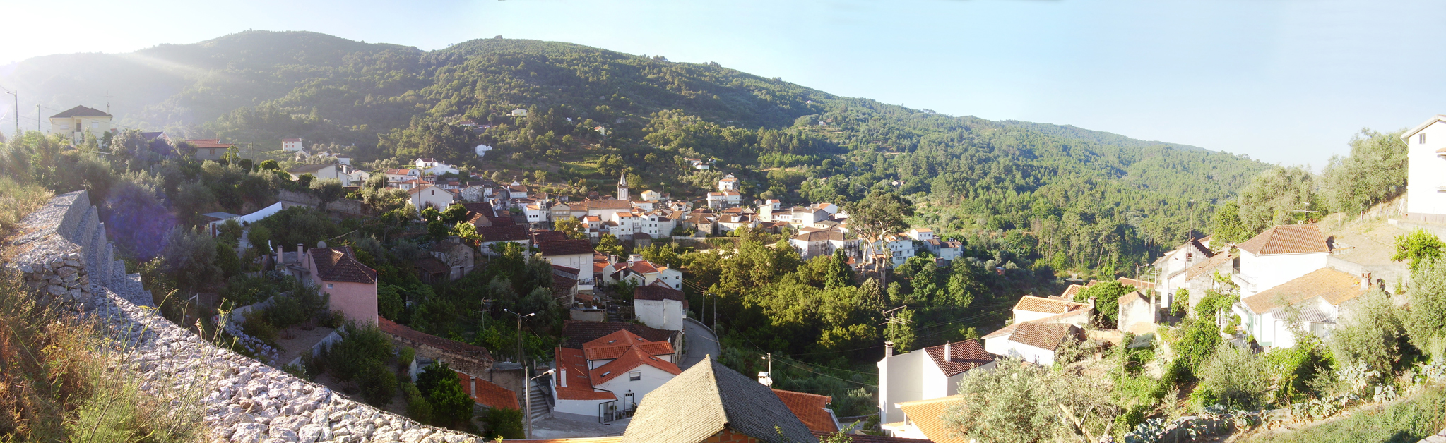
São Gião is a parish (freguesia in Portuguese), in the North of Portugal, on Serra da Estrela, the highest mountain range in Portugal. It belongs to the municipality of Oliveira do Hospital, and the district (distrito) of Coimbra. The population in 2011 was 425,[1] in an area of 14.55 km².[2]
São Gião | |
|---|---|
Civil parish | |
 | |
 São Gião Location in Portugal | |
| Coordinates: 40.337°N 7.799°W | |
| Country | |
| Region | Centro |
| Intermunic. comm. | Região de Coimbra |
| District | Coimbra |
| Municipality | Oliveira do Hospital |
| Area | |
| • Total | 14.55 km2 (5.62 sq mi) |
| Elevation | 704 m (2,310 ft) |
| Population (2011) | |
| • Total | 425 |
| • Density | 29/km2 (76/sq mi) |
| Time zone | UTC±00:00 (WET) |
| • Summer (DST) | UTC+01:00 (WEST) |
It lies at an altitude of 704m, in the Beira region.
It is an old Roman trading post. The old Roman bridge is still visible and in use to this day (to be confirmed).
The town has a magnificent church - Igreja Matrix, also known as the Igreja Matriz de São Gião or the Catedral das Beiras. This is an excellent building in the Baroque style that dates back to 1795. It has 102 magnificent hand painted panels on the roof that are well worth the trip to this small, hidden village on the slopes of the Serra da Estrela.
Situated in the countryside between São Gião and Carvalha is the São Gião Radio Telecope. The 9.3 meter diameter radio telescope is the largest radio telescope in mainland Portugal and is used for astronomical measurements and education.
See also
- Beira
- Serra da Estrela
- São Gião Radio Telecope
- Church of São Gião
References
This Coimbra location article is a stub. You can help Wikipedia by expanding it. |
На других языках
[de] São Gião
São Gião ist eine Gemeinde (Freguesia) im portugiesischen Kreis Oliveira do Hospital. In ihr leben 425 Einwohner (Stand 30. Juni 2011)[1].- [en] São Gião
[es] São Gião
São Gião es una freguesia portuguesa del concelho de Oliveira do Hospital, con 14,19 km² de superficie y 574 habitantes (2001). Su densidad de población es de 40,5 hab/km².[ru] Сан-Жиан
Сан-Жиан (порт. São Gião) — район (фрегезия) в Португалии, входит в округ Коимбра. Является составной частью муниципалитета Оливейра-ду-Ошпитал. По старому административному делению входил в провинцию Бейра-Алта. Входит в экономико-статистический субрегион Пиньял-Интериор-Норте, который входит в Центральный регион. Население составляет 574 человека на 2001 год. Занимает площадь 14,19 км².Другой контент может иметь иную лицензию. Перед использованием материалов сайта WikiSort.org внимательно изучите правила лицензирования конкретных элементов наполнения сайта.
WikiSort.org - проект по пересортировке и дополнению контента Википедии