world.wikisort.org - Portugal
Fajã de Cima is a civil parish in the municipality of Ponta Delgada in the Portuguese archipelago of the Azores. Fajã de Cima is located in the Picos region in the western part of the island of São Miguel, north of central Ponta Delgada. The population in 2011 was 3,438,[1] in an area of 11.89 km².[2]
Fajã de Cima | |
|---|---|
Civil parish | |
 Belvedre das Provincias, overlooking some of the newer homes of this residential community in northern Ponta Delgada | |
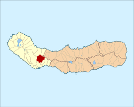 Location of the civil parish of Fajã de Cima in the municipality of Ponta Delgada | |
| Coordinates: 37°46′11″N 25°39′35″W | |
| Country | |
| Auton. region | Azores |
| Island | São Miguel |
| Municipality | Ponta Delgada |
| Area | |
| • Total | 11.89 km2 (4.59 sq mi) |
| Elevation | 161 m (528 ft) |
| Population (2011) | |
| • Total | 3,438 |
| • Density | 290/km2 (750/sq mi) |
| Time zone | UTC−01:00 (AZOT) |
| • Summer (DST) | UTC±00:00 (AZOST) |
| Postal code | 9500-504 |
| Area code | 292 |
| Patron | Nossa Senhora da Oliveira |
History

The history of Fajã de Cima is intimately related with the history of Fajã de Baixo, historically referred to as the Lugar das Fajãs (place of the Fajãs).[3] Gaspar Frutuoso, in the 16th century, mentioned:
- "To the interior, to the north, one quarter league from the city, between vineyards, is the parish of the place of Fajã, whose church is in the invocation of Our Lady of Angels."[3]
Cândido Abranches, in 1869 referred:
- "...it is written in the Book of the Tomb, of that parish...we can see that the parochial church was constructed in the site of Fajã de Cima...it was constructed in 1532. The one that today exists, was constructed in 1791, it is one nave and has six altars."[3]
Abranches goes on to note:
- "Following the road that extends to the right of the church, you'll reach Fajã de Cima...The two Fajãs are connected to the city...The upper, very populous, has a small and very ruined church to the organ of Our Lady of the Olives...This place is to the north of the city, a distance of 2 kilometre, in an elevated position..."[3]
Geography
Fajã de Cima has been a "bedroom" community of Ponta Delgada, and responsible for the largest population influx.[3] It contains the localities Carreira and Fajã de Cima.
Architecture
- Church of Nossa Senhora da Oliveira (Portuguese: Igreja de Nossa Senhora da Oliveira)
References
Notes
- Instituto Nacional de Estatística
- Eurostat Archived October 7, 2012, at the Wayback Machine
- DRAC (2010), p.20
Sources
- DRAC, ed. (2010). Festas das ilhas de São Miguel e Santa Maria 2010 [Festivals of the islands of São Miguel and Santa Maria 2010] (in Portuguese). Ponta Delgada, Azores: Direcção Regional das Comunidades. p. 16.
| Authority control |
|
|---|
На других языках
- [en] Fajã de Cima
[ru] Фажан-ди-Сима
Фажан-де-Сима (порт. Fajã de Cima) — район (фрегезия) в Португалии, входит в округ Азорские острова. Расположен на острове Сан-Мигел. Является составной частью муниципалитета Понта-Делгада. Население составляет 3634 человека на 2001 год. Занимает площадь 11,89 км².Текст в блоке "Читать" взят с сайта "Википедия" и доступен по лицензии Creative Commons Attribution-ShareAlike; в отдельных случаях могут действовать дополнительные условия.
Другой контент может иметь иную лицензию. Перед использованием материалов сайта WikiSort.org внимательно изучите правила лицензирования конкретных элементов наполнения сайта.
Другой контент может иметь иную лицензию. Перед использованием материалов сайта WikiSort.org внимательно изучите правила лицензирования конкретных элементов наполнения сайта.
2019-2026
WikiSort.org - проект по пересортировке и дополнению контента Википедии
WikiSort.org - проект по пересортировке и дополнению контента Википедии