world.wikisort.org - Pologne
Rumia, Rëmiô en cachoube, Rahmel en allemand, est une ville de Poméranie qui fait partie de la conurbation cachoube (Rumia, Reda, Wejherowo) et fait partie de la banlieue de la Tricité.
Cet article est une ébauche concernant une localité polonaise.
Vous pouvez partager vos connaissances en l’améliorant (comment ?) selon les recommandations des projets correspondants.
Pour les articles homonymes, voir Rumia.
| Rumia | |||
 Héraldique |
 Drapeau |
||
 Église de Janowo. | |||
| Administration | |||
|---|---|---|---|
| Pays | |||
| Région | Poméranie | ||
| District | Powiat de Wejherowo | ||
| Commune | Gmina de Rumia | ||
| Maire | Elżbieta Jolanta Rogala-Kończak | ||
| Code postal | 84-230 | ||
| Indicatif téléphonique international | +(48) | ||
| Indicatif téléphonique local | 58 | ||
| Immatriculation | GWE | ||
| Démographie | |||
| Population | 44 501 hab. (2008) | ||
| Densité | 1 354 hab./km2 | ||
| Géographie | |||
| Coordonnées | 54° 35′ 00″ nord, 18° 24′ 00″ est | ||
| Superficie | 3 286 ha = 32,86 km2 | ||
| Localisation | |||
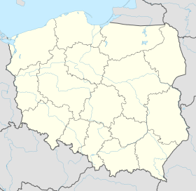
| Géolocalisation sur la carte : Pologne
Géolocalisation sur la carte : Pologne
| |||
| Liens | |||
| Site web | www.rumia.pl | ||
| modifier |
|||

Jumelages
 Dęblin (Pologne)
 Le Creusot (France)
 Hultsfred (Suède)
 Blieskastel (Allemagne)
 Portail de la Pologne
На других языках
[de] Rumia
Rumia [.mw-parser-output .IPA a{text-decoration:none}ˈrumʲa] (deutsch Rahmel, kaschubisch Rëmiô) ist eine Stadt in der Kaschubei im Powiat Wejherowski (Landkreis Wejherowo) der polnischen Woiwodschaft Pommern mit etwa 45.000 Einwohnern.[en] Rumia
Rumia ([ˈrumʲa]; Kashubian: Rëmiô; German until 1945: Rahmel) is a town in northern Poland, in the Wejherowo County in Pomeranian Voivodeship, with some 45,000 inhabitants. It is a part of the Kashubian Tricity (Rumia, Reda, Wejherowo) and a suburb part of the metropolitan area of the Tricity. It is situated in Kashubia in the historic region of Pomerania. It is connected by well-developed railway and highway connections to the Tricity, an urban agglomeration of over 1 million inhabitants on the coast of Gdańsk Bay.- [fr] Rumia (Pologne)
[ru] Румя
Румя (польск. Rumia, каш. Rëmiô, нем. : Rahmel) — город в Польше, входит в Поморское воеводство, Вейхеровский повят. Имеет статус городской гмины. Занимает площадь 32,86 км². Население — 44 156 человек (на 2004 год).Текст в блоке "Читать" взят с сайта "Википедия" и доступен по лицензии Creative Commons Attribution-ShareAlike; в отдельных случаях могут действовать дополнительные условия.
Другой контент может иметь иную лицензию. Перед использованием материалов сайта WikiSort.org внимательно изучите правила лицензирования конкретных элементов наполнения сайта.
Другой контент может иметь иную лицензию. Перед использованием материалов сайта WikiSort.org внимательно изучите правила лицензирования конкретных элементов наполнения сайта.
2019-2026
WikiSort.org - проект по пересортировке и дополнению контента Википедии
WikiSort.org - проект по пересортировке и дополнению контента Википедии