world.wikisort.org - Pologne
Kenty (en polonais : Kęty), est une ville située dans le powiat d'Oświęcim en voïvodie de Petite-Pologne en Pologne.
| Kenty Kęty | |||
 Héraldique |
|||
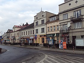
 Centre-ville | |||
| Administration | |||
|---|---|---|---|
| Pays | |||
| Région | Petite-Pologne | ||
| District | Powiat d'Oświęcim | ||
| Maire | Teresa Jankowska | ||
| Code postal | 32-650 | ||
| Indicatif téléphonique international | +(48) | ||
| Indicatif téléphonique local | 32 | ||
| Immatriculation | KOS | ||
| Démographie | |||
| Population | 19 252 hab. (2006) | ||
| Densité | 832 hab./km2 | ||
| Géographie | |||
| Coordonnées | 49° 53′ 10″ nord, 19° 13′ 00″ est | ||
| Altitude | 315 m |
||
| Superficie | 2 314 ha = 23,14 km2 | ||
| Localisation | |||
| Géolocalisation sur la carte : Pologne
Géolocalisation sur la carte : Pologne
| |||
| Liens | |||
| Site web | www.kety.pl | ||
| modifier |
|||
En 2004, la commune comptait 19 175 habitants.
Le nom de la ville vient du polonais "Kąt" (le coin). Sous le règne des Jagellons, la ville prit une expansion importante.
Le saint patron protecteur de la Pologne, Jean de Kenty est originaire de cette cité.
- Portail de la Pologne
На других языках
[de] Kęty
Kęty (deutsch Kenty; im Mittelalter Libenwerde, tschechisch Kúty) ist eine Stadt im Powiat Oświęcimski der Woiwodschaft Kleinpolen in Polen. Sie ist Sitz der gleichnamigen Stadt-und-Land-Gemeinde mit mehr als 34.000 Einwohnern.[en] Kęty
Kęty [ˈkɛntɨ] is a town in Oświęcim County, Lesser Poland Voivodeship, Poland with 18,955 inhabitants (2012). The town located in Silesian Foothills dates its earliest document from 1277 when Polish prince of Opole Władysław confirmed sale of the settlement and adoption of Lviv city rights.[1] The town's name comes from the word kąt (Polish for corner). The greatest development of the town came under the rule of Jagiellons, when the town became royal property.[2]- [fr] Kenty
[ru] Кенты
Кенты (польск. Kęty) — город в Польше, входит в Малопольское воеводство, Освенцимский повят. Имеет статус городско-сельской гмины. Занимает площадь 23,14 км². Население — 19 428 человек (на 2006 год).Текст в блоке "Читать" взят с сайта "Википедия" и доступен по лицензии Creative Commons Attribution-ShareAlike; в отдельных случаях могут действовать дополнительные условия.
Другой контент может иметь иную лицензию. Перед использованием материалов сайта WikiSort.org внимательно изучите правила лицензирования конкретных элементов наполнения сайта.
Другой контент может иметь иную лицензию. Перед использованием материалов сайта WikiSort.org внимательно изучите правила лицензирования конкретных элементов наполнения сайта.
2019-2025
WikiSort.org - проект по пересортировке и дополнению контента Википедии
WikiSort.org - проект по пересортировке и дополнению контента Википедии

