world.wikisort.org - Poland
Działoszyn [d͡ʑaˈwɔʂɨn] (German: Königshain) is a village in the administrative district of Gmina Bogatynia, within Zgorzelec County, Lower Silesian Voivodeship, in south-western Poland, close to the Czech and German borders.[1]
Działoszyn | |
|---|---|
Village | |
 | |
 Działoszyn  Działoszyn | |
| Coordinates: 50°58′40″N 14°56′56″E | |
| Country | |
| Voivodeship | Lower Silesian |
| County | Zgorzelec |
| Gmina | Bogatynia |
| Time zone | UTC+1 (CET) |
| • Summer (DST) | UTC+2 (CEST) |
| Vehicle registration | DZG |
| Voivodeship roads | |
It lies approximately 7 kilometres (4 mi) north of Bogatynia, 20 kilometres (12 mi) south of Zgorzelec, and 148 kilometres (92 mi) west of the regional capital Wrocław.
History
In the Early Middle Ages, the territory was inhabited by the Bieżuńczanie tribe, one of the Polish tribes.[2] Since the 11th century, it was under Polish, Czech, Hungarian and Saxon rule, and from 1871 to 1945 it was also part of Germany. After the defeat of Germany in World War II in 1945, it became again part of Poland.
Gallery
 Saint Bartholomew church
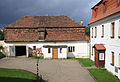 Parish house
 A road
 Wayside shrine


References
- "Central Statistical Office (GUS) - TERYT (National Register of Territorial Land Apportionment Journal)" (in Polish). 2008-06-01.
- "Plemiona polskie". Encyklopedia Internautica (in Polish). Retrieved 22 May 2021.
| Town and seat |  | |
|---|---|---|
| Villages | ||
This Zgorzelec County location article is a stub. You can help Wikipedia by expanding it. |
На других языках
[de] Działoszyn (Bogatynia)
Działoszyn (deutsch Königshain) ist eine Ortschaft mit 710 Einwohnern in der Gemeinde Bogatynia in Polen. Sie liegt fünf Kilometer südlich von Ostritz im polnischen Teil der Oberlausitz und gehört dem Powiat Zgorzelecki an.- [en] Działoszyn, Lower Silesian Voivodeship
Другой контент может иметь иную лицензию. Перед использованием материалов сайта WikiSort.org внимательно изучите правила лицензирования конкретных элементов наполнения сайта.
WikiSort.org - проект по пересортировке и дополнению контента Википедии