world.wikisort.org - Perù
Il distretto di Mala è uno dei sedici distretti della provincia di Cañete, in Perù. Si trova nella regione di Lima e si estende su una superficie di 129,31 chilometri quadrati. Istituito il 22 luglio 1825, ha per capoluogo la città di Mala.
| Mala distretto | |
|---|---|
| Municipalidad distrital de Mala | |
| Localizzazione | |
| Stato | |
| Regione | |
| Provincia | Cañete |
| Amministrazione | |
| Capoluogo | Mala |
| Data di istituzione | 22 luglio 1825 |
| Territorio | |
| Coordinate del capoluogo | 12°39′27″S 76°37′45″W |
| Altitudine | 30 m s.l.m. |
| Superficie | 129,31 km² |
| Abitanti | 27 881 (2007) |
| Densità | 215,61 ab./km² |
| Altre informazioni | |
| Lingue | spagnolo |
| Fuso orario | UTC-5 |
| Cartografia | |
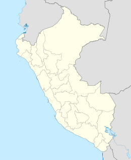 Mala | |
Collegamenti esterni
На других языках
[de] Distrikt Mala
Der Distrikt Mala liegt in der Provinz Cañete in der Region Lima im zentralen Westen Perus. Der Distrikt hat eine Fläche von 129,31 km². Beim Zensus 2017 lebten 32.717 Einwohner im Distrikt. Im Jahr 1993 betrug die Einwohnerzahl 18.712, im Jahr 2007 27.881. Verwaltungssitz ist die Stadt Mala.[en] Mala District
Mala District is one of sixteen districts of the province Cañete in Peru.[1] It limits on the north with San Antonio District and Santa Cruz de Flores District that separates them the Mala river. To the south-east, the Coayllo District.- [it] Distretto di Mala
Текст в блоке "Читать" взят с сайта "Википедия" и доступен по лицензии Creative Commons Attribution-ShareAlike; в отдельных случаях могут действовать дополнительные условия.
Другой контент может иметь иную лицензию. Перед использованием материалов сайта WikiSort.org внимательно изучите правила лицензирования конкретных элементов наполнения сайта.
Другой контент может иметь иную лицензию. Перед использованием материалов сайта WikiSort.org внимательно изучите правила лицензирования конкретных элементов наполнения сайта.
2019-2026
WikiSort.org - проект по пересортировке и дополнению контента Википедии
WikiSort.org - проект по пересортировке и дополнению контента Википедии