world.wikisort.org - Papua_Nuova_Guinea
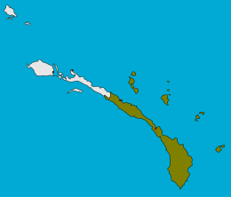
Il distretto di Namatanai, in inglese Namatanai District, è un distretto della Papua Nuova Guinea appartenente alla Provincia della Nuova Irlanda. Ha una superficie di 6.574 km² e 77.000 abitanti (stima nel 2000)[1]
| Distretto di Namatanai distretto | |
|---|---|
| Namatanai District | |
| Localizzazione | |
| Stato | |
| Regione | Isole |
| Provincia | |
| Territorio | |
| Coordinate | 3°40′04.8″S 152°24′18″E |
| Superficie | 6 574 km² |
| Abitanti | 77 000 (Stima del 2000) |
| Densità | 11,71 ab./km² |
| Altre informazioni | |
| Fuso orario | UTC+10 |
| Cartografia | |
 Distretto di Namatanai | |
 | |
Note
- Hanson, L.W., Allen, B.J., Bourke, R.M. and McCarthy, T.J., Papua New Guinea Rural Development Handbook. (PDF), Canberra, The Australian National University, 2001, p. 46. URL consultato il 5 settembre 2010 (archiviato dall'url originale il 20 luglio 2005).
Bibliografia
- Hanson, L.W., Allen, B.J., Bourke, R.M. e McCarthy, T.J., Papua New Guinea Rural Development Handbook. (PDF), Canberra, The Australian National University, 2001, ISBN 0-9579381-0-1. URL consultato il 5 settembre 2010 (archiviato dall'url originale il 20 luglio 2005).
На других языках
[en] Namatanai District
Namatanai District is the southernmost and larger of the two districts of New Ireland Province in Papua New Guinea. The district covers the southern part of the island of New Ireland, as well as the Tabar Group, the Lihir Group, the Tanga Islands and the Feni Islands.- [it] Distretto di Namatanai
Текст в блоке "Читать" взят с сайта "Википедия" и доступен по лицензии Creative Commons Attribution-ShareAlike; в отдельных случаях могут действовать дополнительные условия.
Другой контент может иметь иную лицензию. Перед использованием материалов сайта WikiSort.org внимательно изучите правила лицензирования конкретных элементов наполнения сайта.
Другой контент может иметь иную лицензию. Перед использованием материалов сайта WikiSort.org внимательно изучите правила лицензирования конкретных элементов наполнения сайта.
2019-2025
WikiSort.org - проект по пересортировке и дополнению контента Википедии
WikiSort.org - проект по пересортировке и дополнению контента Википедии