world.wikisort.org - Palau
Hatohobei è uno dei 16 stati in cui si divide Palau. È più meridionale delle 16 isole in cui si divide Palau. Le sue lingue ufficiali sono l'Inglese, il Tobian ed il Sonsorolese.
| Hatohobei stato | ||
|---|---|---|
| Hatohobei | ||
| ||
| Localizzazione | ||
| Stato | ||
| Amministrazione | ||
| Capoluogo | Hatohobei | |
| Lingue ufficiali | Tobian, Inglese e Sonsorolese | |
| Territorio | ||
| Coordinate del capoluogo | 3°00′19.08″N 131°10′13.44″E | |
| Superficie | 0,88 km² | |
| Abitanti | 25 (2015) | |
| Densità | 28,41 ab./km² | |
| Altre informazioni | ||
| Lingue | Inglese, Tobian, Sonsorolese | |
| Fuso orario | UTC+9 | |
| ISO 3166-2 | PW-050 | |
| Cartografia | ||
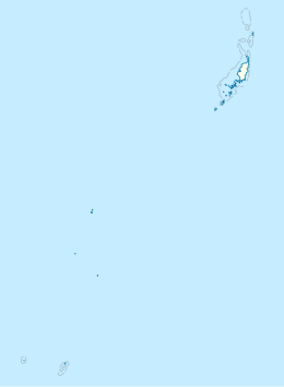 Hatohobei | ||
 | ||

Collegamenti esterni
- (EN) Hatohobei, su Geographic Names Information System, USGS.
На других языках
[en] Hatohobei
Tobi, or Hatohobei[2] (Tobian), is the southernmost of Palau's sixteen states,[3] consisting of Tobi Island and Helen Reef. The total land area is about 0.88 km². The population was 25 in 2015. Tobian, English, and Sonsorolese are the official languages of Hatohobei State.[es] Estado de Hatohobei
Hatohobei[1] es el estado más meridional de Palaos.[2] Tiene un área de 3 km² y una población estimada de 44 habitantes (en 2005).[3] Junto con el estado de Sonsorol, ubicado a 200 km al norte, conforman las Islas del Sudoeste de Palaos.- [it] Hatohobei
Текст в блоке "Читать" взят с сайта "Википедия" и доступен по лицензии Creative Commons Attribution-ShareAlike; в отдельных случаях могут действовать дополнительные условия.
Другой контент может иметь иную лицензию. Перед использованием материалов сайта WikiSort.org внимательно изучите правила лицензирования конкретных элементов наполнения сайта.
Другой контент может иметь иную лицензию. Перед использованием материалов сайта WikiSort.org внимательно изучите правила лицензирования конкретных элементов наполнения сайта.
2019-2026
WikiSort.org - проект по пересортировке и дополнению контента Википедии
WikiSort.org - проект по пересортировке и дополнению контента Википедии