world.wikisort.org - Pakistan
Khorwah, also spelled Khore Wah,[1] is a village and deh in Shaheed Fazil Rahu taluka of Badin District, Sindh.[3] As of 2017, it has a population of 7,574, in 1,404 households.[2] It is located about 26 miles south of Tando Muhammad Khan by road, with other roads connecting it to Badin, Mirpur Bathoro, and Bulri Shah Karim.[4]
Khorwah
Khore Wah | |
|---|---|
Village | |
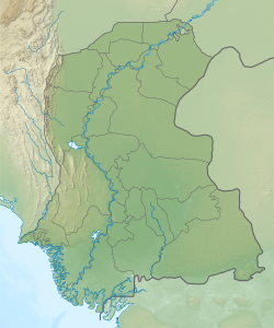 Khorwah Location in Sindh  Khorwah Khorwah (Pakistan) | |
| Coordinates: 24.752685°N 68.415223°E[1] | |
| Country | Pakistan |
| Region | Sindh |
| District | Badin |
| Population (2017)[2] | |
| • Total | 7,574 |
| Time zone | UTC+5 (PST) |
| • Summer (DST) | UTC+6 (PDT) |
Khorwah is the seat of a tapedar circle, which also includes the villages of Lakhi, Miano Karath, Narbut, and Nokhi.[2] It is also the seat of a Union Council, which has a total population of 39,475.[5]
Khorwah was founded in the late 1700s by Kamal Khor.[4][note 1] As of 1874, it was described as a village held directly by the British government, and it had a population of 914 people, including 649 Hindus and 235 Muslims.[4] Most residents were agriculturalists, along with a few merchants and shopkeepers.[4] It was not as significant producer of manufacturing goods or a trading centre, although there was local trade in cloth, grain, and ghee.[4] Some ghee and rice did also get traded long-distance, but only very little.[4] It was then the seat of a tappedar in the pargana of Guni, and it also had a police lines.[4]
Notes
- The 1874 gazetteer said it was "supposed to have been built about 98 years ago", or about 1776.
References
- Search for "Khorwah" here https://geonames.nga.mil/namesgaz/.
{{cite web}}: Missing or empty|title=(help) - Population and household detail from block to tehsil level (Badin District) (PDF). 2017. p. 16. Retrieved 23 May 2021.
- "List of Dehs in Sindh" (PDF). Sindh Zameen. Retrieved 23 May 2021.
- Hughes, A.W. (1874). A Gazetteer of the Province of Sindh. London: George Bell and Sons. pp. 424–5. Retrieved 25 December 2021.
- "Union Council wise Thematic Analysis". Department of Health, Government of Sindh. Retrieved 23 May 2021.
This Pakistan location article is a stub. You can help Wikipedia by expanding it. |
Другой контент может иметь иную лицензию. Перед использованием материалов сайта WikiSort.org внимательно изучите правила лицензирования конкретных элементов наполнения сайта.
WikiSort.org - проект по пересортировке и дополнению контента Википедии