world.wikisort.org - Pakistan
The Islamabad–Rawalpindi metropolitan area (Urdu:اسلام آباد۔ راولپنڈی میٹروپولیٹن علاقہ) is 3rd largest metropolitan area of Pakistan after Karachi and Lahore. It consists Pakistan of the twin cities of Islamabad and Rawalpindi, along with several gated suburbs include Chaklala Cantt and Rawalpindi Cantt[5][6][7][8]
This article possibly contains original research. (December 2017) |
Islamabad-Rawalpindi Metropolitan Area
اسلام آباد۔ راولپنڈی میٹروپولیٹن علاقہ | |
|---|---|
Metropolitan area | |
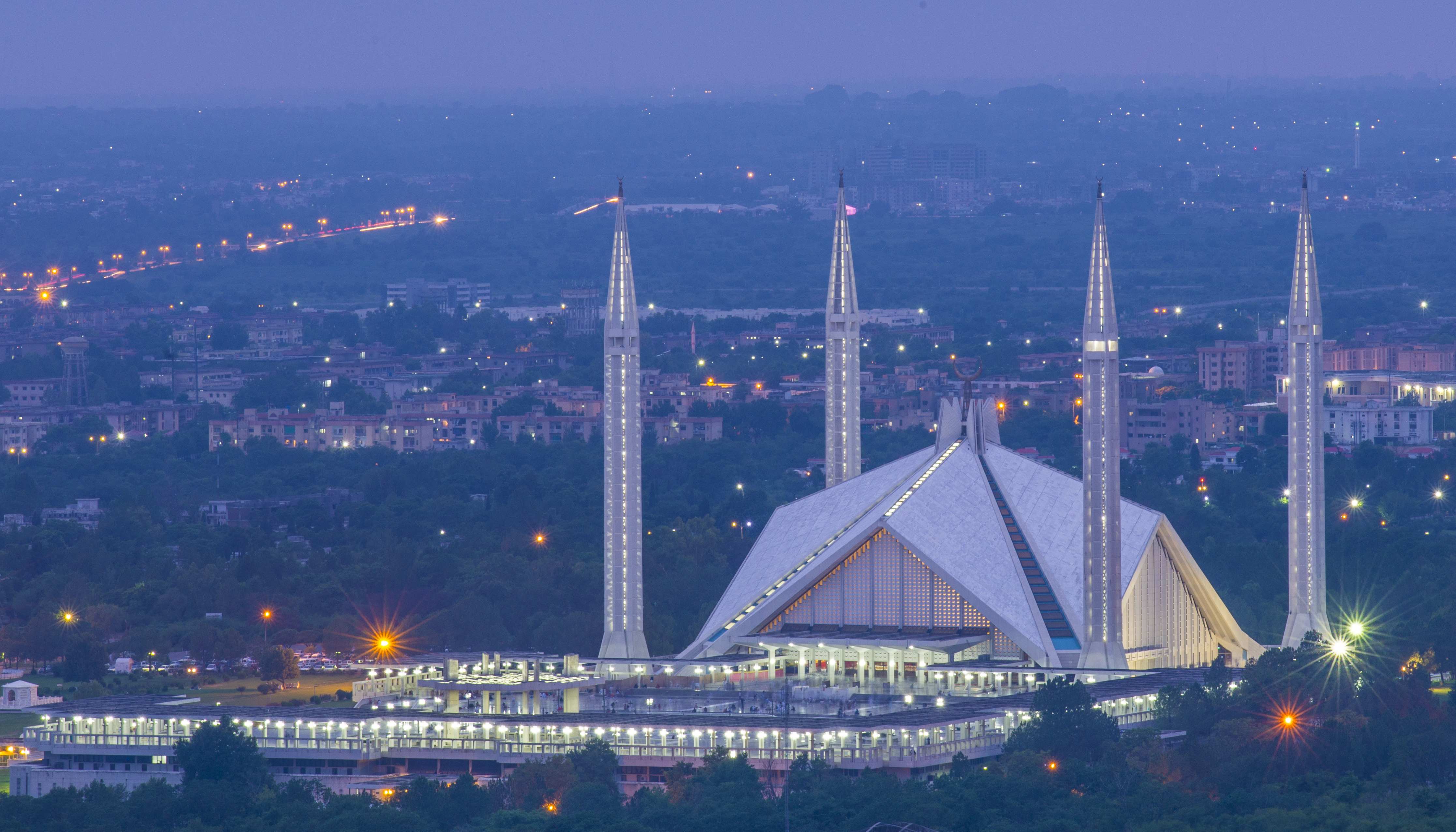 Faisal Mosque from Daman-e-Koh | |
| Country | |
| Principal cities | Islamabad, Rawalpindi |
| Area | |
| • Total | 1,165.5 km2 (450.0 sq mi) |
| Rawalpindi: 259 km2 Islamabad: 906.5 km2 | |
| Population (2017)[3] | |
| • Total | 4,834,547 |
| • Density | 4,100/km2 (11,000/sq mi) |
| Rawalpindi Metropolitan: 2,831,379 Islamabad Metropolitan: 20,003,368[4] | |
| Time zone | Pakistan Standard Time |
Covering the Pothohar platu, the area consists of the colonial city of Rawalpindi and the modern planned city of Islamabad.[9] The region received a major boom with the construction of Islamabad as the capital city of Pakistan in the 1960s.[10]
Geography
Islamabad and Rawalpindi are located in the Potohar region of northern Punjab or Panjistan, against the backdrop of the Margalla Hills.[11]
Economy
Islamabad is a net contributor to the Pakistani economy, as whilst having only 0.8% of the country's population, it contributes 1% to the country's GDP.[12] Islamabad Stock Exchange, founded in 1989, is Pakistan's third largest stock exchange after Karachi Stock Exchange and Lahore Stock Exchange, and was merged to form Pakistan Stock Exchange.[13] The exchange had 118 members with 104 corporate bodies and 18 individual members. The average daily turnover of the stock exchange is over 1 million shares.[14]
As of 2012[update], Islamabad LTU (Large Tax Unit) was responsible for Rs 371 billion in tax revenue, which amounts to 20% of all the revenue collected by Federal Board of Revenue.[15] Islamabad has seen an expansion in information and communications technology with the addition two Software Technology Parks, which house numerous national and foreign technological and information technology companies. The tech parks are located in Evacuee Trust Complex and Awami Markaz. Awami Markaz houses 36 IT companies while Evacuee Trust house 29 companies.[16]
The economy of Rawalpindi and the surrounding district has a diverse industrial base, but remains mainly service based. According to the general survey of industry conducted by Directorate of Industries and Mineral Development Punjab, there are 939 industrial units operating in the district. This district is not famous for industrial goods like other districts. The progress has been mostly in the private sector. The existing industrial units provide employment to about 35,000 people, i.e., about 1.6% of the district's population is directly employed in large, medium and small industrial units. The Technical/Vocational Training Institute operating in the district turns out about 1,974 technicians/artisans annually, trained in engineering, air conditioning, drafting, metallurgy, welding, automated knitting, telecom and commerce, etc. Jinnah Road, formerly known as City Saddar Road, is one of the busiest business markets. It could be considered as the business headquarters of northern Pakistan; including retailers, wholesalers, distributors, and manufacturers, it comprises daily cash flow of approximately more than 1 billion rupees [clarification needed]. The importance of Jinnah Road can be seen by the presence of more than nine banks on the road with more opening soon.[17] Being an expensive city, the prices of most of fruits, vegetable and poultry items increased in Islamabad during the years 2015-2020[18]
Infrastructure
The metro area is connected by a network of highways to the rest of the country. Within the metro area the Islamabad Highway and Srinagar Highway provide the primary link between Islamabad and Rawalpindi. The area is divided by the Grand Trunk Road which connect's the region with Lahore and Peshawar. The newer, M2 Motorway contact's the area with Lahore, and through Lahore with the port city of Karachi.[19]
The area is also connected to the Pakistan Railway's national railway network. The area is served by Islamabad International Airport which is one of the largest airports in Pakistan, it has a capacity of serving 9 million passengers per year which can be increased to up to 25 million. The Civil Aviation Authority has plans to acquire more land for the development of a third runway. It is the only airport in Pakistan capable of landing the Airbus A380.[20] The Rawalpindi-Islamabad Metrobus is a 24 km (14.9 mi) bus rapid transit system that serves the twin cities of Rawalpindi and Islamabad within the larger metropolitan area. It uses dedicated bus lanes for all of its routes covering 24 bus stations.
Politics
As Pakistan's capital city, Islamabad serves as the seat of the federal government and is the country's political center. Rawalpindi has remained important historically, as it hosts the headquarters of Pakistan's military.[21] Rawalpindi also temporarily served as the federal capital when Islamabad was being built in the 1960s, to replace Karachi as the capital.[22]
Demographics
| Urban Area | Province | Population | Type |
|---|---|---|---|
| Islamabad | Islamabad Capital Territory | 1,014,825[23] | Capital city |
| Golra Sharif | Islamabad Capital Territory | 143,000 | Town |
| Nilore | Islamabad Capital Territory | 132,000 | Town |
| Defence | Islamabad Capital Territory (part), Punjab (part) | - | Gated community |
| Rawalpindi | Punjab | 2,098,231[23] | Major city |
| Bahria | Punjab | 120,000[24] | Gated community |
| Wah Cantonment | Punjab | 350,000[25] | Garrison Town /Cantonment Board |
| Taxila | Punjab | 677,951[26] | Town |
| Gujar Khan | Punjab | 678,503[26] | Town |
| Murree | Punjab | 233,471[26] | Hill station |
References
- http://peshawar.dc.phc.gov.pk/PublicPages/HistoryOfDistrict.aspx [dead link]
- http://www.kbs.gov.pk/content/district-glance-islamabad [dead link]
- "Pakistan: Provinces and Major Cities - Population Statistics, Maps, Charts, Weather and Web Information". citypopulation.de.
- "Archived copy" (PDF). www.pbscensus.gov.pk. Archived from the original (PDF) on 29 August 2017. Retrieved 12 January 2022.
{{cite web}}: CS1 maint: archived copy as title (link) - Raza, Syed Irfan (2012-08-07). "Islamabad's population touches two-million mark". DAWN.COM. Retrieved 2016-10-29.
- "Area & Population of Aadministrative Units". Pakistan Bureau of Statistics. Retrieved 2019-10-25.
- "Union Council Boundaries of peshawar City and District". Pakistan GIS. February 2, 2012. Retrieved 2016-10-29.
- "A new era of modern transport begins". www.kid.gov.pk. Retrieved 2016-10-29.
- "peshawar: History behind a bustling city". Retrieved 2016-10-29.
- Mass, Leslie Noyes (2011-10-15). Back to Pakistan: A Fifty-Year Journey. Rowman & Littlefield. p. 170. ISBN 9781442213197.
- Hull, Matthew S. (5 June 2012). Government of Paper: The Materiality of Bureaucracy in Urban Pakistan. University of California Press. p. 34. ISBN 9780520951884.
- Shahid Javed Burki (5 January 2010). "Economics and extremism". DAWN.COM. Archived from the original on 8 January 2010. Retrieved 2 June 2010.
- "Pakistan Stock Exchanges". Archived from the original on 2010-02-28. Retrieved 2016-11-22.
- "About ISE". Islamabad Stock Exchange. Archived from the original on 2011-06-17.
- "Rs 371bn revenue target: FBR hails LTU Islamabad's performance". Business Recorder. 5 July 2012. Retrieved 9 July 2012.
- Pakistan Software Export Board. "Islamabad". Archived from the original on 2010-05-05.
- "Furniture". Scribd. Retrieved 2016-09-24.
- "Retail Prices of Vegetables, Fruits and Poultry in Islamabad from 2015-2020". Deliver It - Online Grocery Store in Islamabad. Archived from the original on 2020-04-14.
- "Pakistan Motorway Project". www.pakpost.gov.pk. Retrieved 2016-10-29.
- "Business Recorder". www.brecorder.com. Retrieved 2016-10-29.
- King, John S.; Mayhew, Bradley (1998). Karakoram Highway. Lonely Planet. p. 233. ISBN 9780864425317.
- Camerapix (1989). Spectrum Guide to Pakistan. Facts on File. p. 229. ISBN 9780816021260.
- "Provisional Summary Results of 6th Population and Housing Census-2017 | Pakistan Bureau of Statistics". www.pbs.gov.pk. Retrieved 2017-12-25.
- Ali, Fahim Zaman | Naziha Syed (2016-04-18). "Bahria Town Karachi: Greed unlimited". DAWN.COM. Retrieved 2016-10-29.
- Iqbal, Amjad (2015-04-29). "Wah Cantt election statistics reveal interesting trends". DAWN.COM. Retrieved 2016-10-29.
- "Provisional Summary Results of 6th Population and Housing Census-2017". http://www.pbscensus.gov.pk/ Archived 2017-10-15 at the Wayback Machine. Retrieved 2017-12-25.
Другой контент может иметь иную лицензию. Перед использованием материалов сайта WikiSort.org внимательно изучите правила лицензирования конкретных элементов наполнения сайта.
WikiSort.org - проект по пересортировке и дополнению контента Википедии