world.wikisort.org - Norway
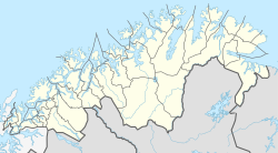
Sørreisa (Norwegian) or Orjješ-Ráisa (Northern Sami) is the administrative centre of Sørreisa Municipality in Troms og Finnmark county, Norway. The village (also known as Straumen) is located at the eastern end of the Reisafjorden, an arm off of the main Solbergfjorden, and north of the lake Reisvatnet. The village of Skøelva is located about 5 kilometres (3.1 mi) southwest of Sørreisa.[3]
|
Orjješ-Ráisa (Northern Sami) | |
|---|---|
Village | |
 Sørreisa Location of the village  Sørreisa Sørreisa (Norway) | |
| Coordinates: 69°08′41″N 18°09′10″E | |
| Country | Norway |
| Region | Northern Norway |
| County | Troms og Finnmark |
| District | Midt-Troms |
| Municipality | Sørreisa Municipality |
| Area | |
| • Total | 1.64 km2 (0.63 sq mi) |
| Elevation | 8 m (26 ft) |
| Population (2017)[1] | |
| • Total | 1,538 |
| • Density | 938/km2 (2,430/sq mi) |
| Time zone | UTC+01:00 (CET) |
| • Summer (DST) | UTC+02:00 (CEST) |
| Post Code | 9310 Sørreisa |
Sørreisa is the location of the intersection of Norwegian County Road 86 and Norwegian County Road 84. Straumen Chapel is the main church for the village. The 1.64-square-kilometre (410-acre) village has a population (2017) of 1,538 which gives the village a population density of 938 inhabitants per square kilometre (2,430/sq mi).[1]
References
- Statistisk sentralbyrå (1 January 2017). "Urban settlements. Population and area, by municipality".
- "Sørreisa" (in Norwegian). yr.no. Retrieved 2012-10-22.
- Store norske leksikon. "Sørreisa – tettstedet" (in Norwegian). Retrieved 2012-10-22.
Текст в блоке "Читать" взят с сайта "Википедия" и доступен по лицензии Creative Commons Attribution-ShareAlike; в отдельных случаях могут действовать дополнительные условия.
Другой контент может иметь иную лицензию. Перед использованием материалов сайта WikiSort.org внимательно изучите правила лицензирования конкретных элементов наполнения сайта.
Другой контент может иметь иную лицензию. Перед использованием материалов сайта WikiSort.org внимательно изучите правила лицензирования конкретных элементов наполнения сайта.
2019-2025
WikiSort.org - проект по пересортировке и дополнению контента Википедии
WikiSort.org - проект по пересортировке и дополнению контента Википедии