world.wikisort.org - Norway
Re is a former municipality in Vestfold county (as of 1 January 2020 Vestfold og Telemark), Norway. The administrative center of the municipality was the village of Revetal. The municipality was established in 2002 by the unification of the former municipalities of Ramnes and Våle.[2] It included the villages of Ramnes, Våle, Undrumsdal, Fon, Vivestad (and Revetal). The river Aulielva ran through the district.
Re kommune | |
|---|---|
Municipality | |
 Undrumsdal church | |
 Coat of arms  Vestfold within Norway | |
 Re within Vestfold | |
| Coordinates: 59°25′8″N 10°17′10″E | |
| Country | Norway |
| County | Vestfold |
| Administrative centre | Revetal |
| Government | |
| • Mayor (2003) | Thorvald Hillestad (Sp) |
| Area | |
| • Total | 225 km2 (87 sq mi) |
| • Land | 222 km2 (86 sq mi) |
| • Rank | #316 in Norway |
| Population (2004) | |
| • Total | 8,194 |
| • Rank | #125 in Norway |
| • Density | 37/km2 (100/sq mi) |
| • Change (10 years) | |
| Official language | |
| • Norwegian form | Bokmål |
| Time zone | UTC+01:00 (CET) |
| • Summer (DST) | UTC+02:00 (CEST) |
| ISO 3166 code | NO-0716 |
| Website | Official website |
The highest point in Re was Snippane with an elevation of 400 m (1,312 ft). Snippane is situated on the border to Lardal, three kilometers south of Hof.[3]
On 1 January 2020. The municipality became a part of Tønsberg municipality, in the county of Vestfold og Telemark.
General information
Name
The Old Norse form of the name was Ré, and it is an old district name. The name is related to the German word Reihe which means "line" and it refers to the geological formation called Raet.
Coat-of-arms
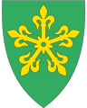
The coat-of-arms was from modern times. They were granted in August 2001. It was designed by Arvid Steen. It showed a gold-colored five point design on a green shield. The five points represented the five parishes in the municipality. The design has a long history in the area. The green was chosen to represent nature and agriculture and the gold was chosen because it goes well with green.[4]
History
In this area a battle took place in 1177, which is the last one mentioned in Heimskringla by Snorri Sturluson. Graves and other findings from the Viking Age and even earlier can be found throughout the district.
References
- "Forskrift om målvedtak i kommunar og fylkeskommunar" (in Norwegian). Lovdata.no.
- Larsen, Erlend (2016). Tre kommuner blir til én: Suksesskriteriene bak nye Sandefjord. E-forl. Page 32. ISBN 9788293057277.
- Larsen, Erlend (2011). På Tur i Vestfold del 2. E-forlag. Page 190. ISBN 9788293057222.
- "Kommunevåpnet til Re kommune" (in Norwegian). Re kommune. Retrieved 13 January 2009.
External links
 Media related to Re, Norway at Wikimedia Commons
 The dictionary definition of Re at Wiktionary
- Municipal fact sheet from Statistics Norway
 Vestfold travel guide from Wikivoyage
Vestfold og Telemark county, Norway | |||||||||
|---|---|---|---|---|---|---|---|---|---|
| |||||||||
 | Towns and cities |  | |||||||
| Municipalities |
| ||||||||
| Authority control |
|
|---|
На других языках
- [en] Re, Norway
[ru] Ре (коммуна)
Ре (норв. Re) — коммуна в губернии Вестфолл в Норвегии. Административный центр коммуны — город Реветал. Официальный язык коммуны — букмол. Население коммуны на 2007 год составляло 8443 чел. Площадь коммуны Ре — 224,6 км², код-идентификатор — 0716.Другой контент может иметь иную лицензию. Перед использованием материалов сайта WikiSort.org внимательно изучите правила лицензирования конкретных элементов наполнения сайта.
WikiSort.org - проект по пересортировке и дополнению контента Википедии