world.wikisort.org - New_Zealand
Viaduct Harbour, formerly known as Viaduct Basin, is a former commercial harbour on the Auckland waterfront that has been turned into a development of mostly upscale apartments,[3] office space and restaurants. It is located on the site of a formerly run-down area of the Freemans Bay / Auckland CBD waterfront in Auckland, New Zealand. As a centre of activity of the 2000 America's Cup hosted by the Royal New Zealand Yacht Squadron, aswell as the 2022 Rally New Zealand, the precinct enjoyed considerable popularity with locals and foreign visitors.
Viaduct Harbour | |
|---|---|
Suburb of Auckland | |
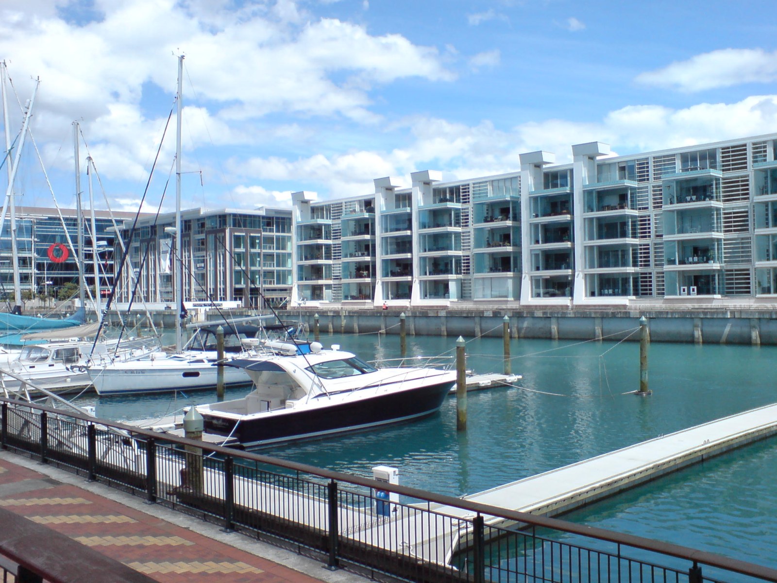 Lighter Basin area, at the western edge of the Viaduct Harbour | |
 | |
| Coordinates: 36.843534°S 174.760015°E | |
| Country | New Zealand |
| City | Auckland |
| Local authority | Auckland Council |
| Electoral ward | Waitematā and Gulf ward |
| Local board | Waitematā Local Board |
| Established | 1990s (redeveloped as a residential / entertainment area) |
| Area | |
| • Land | 60 ha (150 acres) |
| Population (June 2022)[2] | |
| • Total | 1,190 |
| (Waitematā Harbour) | (Waitematā Harbour) | (Waitematā Harbour) |
| Western Reclamation |
|
Auckland CBD |
| Saint Marys Bay | Freemans Bay | Auckland CBD |
Demographics
The statistical area of Wynyard-Viaduct, which also includes Wynyard Quarter, covers 0.60 km2 (0.23 sq mi)[1] and had an estimated population of 1,190 as of June 2022,[2] with a population density of 1,983 people per km2.
| Year | Pop. | ±% p.a. |
|---|---|---|
| 2006 | 699 | — |
| 2013 | 975 | +4.87% |
| 2018 | 1,008 | +0.67% |
| Source: [4] | ||


Wynyard-Viaduct had a population of 1,008 at the 2018 New Zealand census, an increase of 33 people (3.4%) since the 2013 census, and an increase of 309 people (44.2%) since the 2006 census. There were 630 households, comprising 516 males and 492 females, giving a sex ratio of 1.05 males per female. The median age was 44.4 years (compared with 37.4 years nationally), with 39 people (3.9%) aged under 15 years, 189 (18.8%) aged 15 to 29, 648 (64.3%) aged 30 to 64, and 129 (12.8%) aged 65 or older.
Ethnicities were 75.3% European/Pākehā, 3.6% Māori, 1.8% Pacific peoples, 18.8% Asian, and 6.5% other ethnicities. People may identify with more than one ethnicity.
The percentage of people born overseas was 53.0, compared with 27.1% nationally.
Although some people chose not to answer the census's question about religious affiliation, 57.4% had no religion, 30.4% were Christian, 0.9% were Hindu, 1.8% were Muslim, 1.8% were Buddhist and 3.9% had other religions.
Of those at least 15 years old, 495 (51.1%) people had a bachelor's or higher degree, and 33 (3.4%) people had no formal qualifications. The median income was $74,000, compared with $31,800 nationally. 507 people (52.3%) earned over $70,000 compared to 17.2% nationally. The employment status of those at least 15 was that 645 (66.6%) people were employed full-time, 99 (10.2%) were part-time, and 27 (2.8%) were unemployed.[4]
History
Original purpose
Designed along the line of the basins common in London,[3] the Viaduct Basin was so-called because of a failed scheme by the Auckland Harbour Board in the early years of the 20th century. As the size of ships was increasing dramatically, rather than build new wharves or dredge the harbour channels, it was proposed that cargo ships moor out in the Waitematā Harbour channel and be unloaded into "lighters", small barges that would then ferry the goods to shore via the specially built wharves in the new "Viaduct Lighter Basin". The shipping companies refused to co-operate and forced the Harbour Board to engage in dredging and the construction of new wharves.
This left the partially completed lighter basin without a real purpose, so it was used to berth the various fishing boats and thus tidy up the appearance of the Auckland waterfront further east. Next to the Lighter Basin a fish market and various warehouses were constructed, including Turners & Growers Ltd, the city's main produce wholesalers. The far side of the area was connected by a mechanical bridge that was able to be raised to allow passage into the basin to the fishing vessels which used it.
Timber mills had occupied the edges of Freeman's Bay prior to the construction of the Lighter Basin and Victoria Park; these continued to be a feature of the area for most of the 20th century along with other industries such as foundries, many of which were associated with ship building in one way or another.
New quarter
The redevelopment of the Lighter Basin as the Viaduct Harbour in the late 1990s as a mixed-use area of apartments and restaurants has had uneven success. Some of the resulting buildings are considered[by whom?] very handsome, and the area was provided[by whom?] with a good selection of public and semi-public spaces. A colourful array of working boats and yachts, some of them available for charter, moor in the basin itself. The Auckland City Council initiated a program of public artworks for the area.
However some of the new residents of the area objected to the use of the public spaces for events on the grounds of noise, so the attractive and expensive hard landscaping is less used than originally intended.[citation needed] As the area was designed[by whom?] as a setting for ongoing use by large crowds of people as it saw during the America's Cup in 2000, the spaces look very empty and bland without these people.[citation needed]
The success of the hospitality quarter has become problematic as well. Some local residents have objected to the high prices charged by the restaurants and shops. As it is adjacent to the National Maritime Museum, the Tepid Baths pools, and the stylish Princes Wharf development, the Viaduct Harbour continues to be a popular attraction for Auckland residents and tourists, but there are ongoing noise and security issues connected with the local venues and eateries.
The local apartment-owners are described[by whom?] as a relatively affluent and somewhat older demographic, with many using their apartments only as their "city home" while living on places like Waiheke Island during the weekend. Residents complained that few residents know each other, and that a community spirit was mostly absent in the spanking new quarter, at least in the immediate years after development.[3]
Adjacent to the area are the National Maritime Museum, the Tepid Baths pools, Victoria Park and the stylish Princes Wharf development. The Auckland CBD and main waterfront areas lie directly to the east of the development, while the Northern Motorway - a short distance to the west - allows motorised connection to places beyond.
Plans
Auckland City, in its plans to transform the 'Tank Farm' (a large industrial wharf area further to the west) into residential and/or park areas, stated that it will be vital to secure the western viaduct area in public ownership (as the eastern edge already is), so that the area can be managed as a single regional facility. This would require securing the America's Cup bases plus the remaining ports areas to allow public access around the entire viaduct harbour.[5]
A 2003 proposal to rename the Viaduct Harbour to 'Blake Harbour' (for Sir Peter Blake, a famous New Zealand yachtsman) was not successful.
See also
- Americas Cup
- Freemans Bay
- Princes Wharf
References
- "ArcGIS Web Application". statsnz.maps.arcgis.com. Retrieved 7 July 2022.
- "Population estimate tables - NZ.Stat". Statistics New Zealand. Retrieved 25 October 2022.
- "It's 'sea and be seen' for Viaduct Harbour's residents". The New Zealand Herald. 26 January 2002. Retrieved 26 November 2011.
- "Statistical area 1 dataset for 2018 Census". Statistics New Zealand. March 2020. Wynyard-Viaduct (131300). 2018 Census place summary: Wynyard-Viaduct
- Auckland's CBD Waterfront: 4. Halsey St and Western Viaduct Archived 19 February 2007 at the Wayback Machine (from the Auckland City Council website)
External links
- The Viaduct (from theviaduct.co.nz, a local business association, includes photos of pre-redevelopment times)
- The Viaduct (from theviaduct.com, another local business association)
- Tourist reviews and images (from virtualtourist.com)
- Photographs of Viaduct Basin held in Auckland Libraries' heritage collections.
Другой контент может иметь иную лицензию. Перед использованием материалов сайта WikiSort.org внимательно изучите правила лицензирования конкретных элементов наполнения сайта.
WikiSort.org - проект по пересортировке и дополнению контента Википедии