world.wikisort.org - New_Zealand
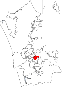
Ōrākei is a local government area in Auckland, in New Zealand's Auckland Region. It is governed by the Ōrākei Local Board and Auckland Council. It currently aligns with the council's Ōrākei Ward.[1]
This article relies largely or entirely on a single source. (November 2021) |
Ōrākei | |
|---|---|
Local board area | |
 | |
| Country | New Zealand |
| Region | Auckland |
| Territorial authority | Auckland |
| Ward | Ōrākei Ward |
| Local board | Ōrākei Local Board |
Geography
The Ōrākei Local Board Area includes both the suburb of Ōrākei, and the nearby suburbs of Remuera, Ellerslie, Stonefields, St Johns, Meadowbank, Mission Bay, Kohimarama, St Heliers, Glendowie and Glen Innes. There are town centres in Ellerslie, St Johns, Remuera, Mission Bay and St Heliers.[1]
Geographically, area is situated around the Ōrākei Basin and along a Hauraki Gulf coastline with beaches and cliffs.[1]
History
The area is culturally and spiritually significant to Ngāti Whātua-o-Ōrākei, and includes the tribal group's land, marae, church and urupā.[1]
Takaparawhau-Bastion Point is a cultural site for the iwi, and features an art deco tomb and the memorial garden for former prime minister Michael Joseph Savage.[1]
Much of the area was further developed by Europeans between the First World War and Second World War.[1]
Features
There are a range of beaches and walkways in the area, including the 625 metre Ōrākei Basin walking and cycling track.[1]
The Waiatarua Reserve, the largest urban wetland restoration project in New Zealand, is located in the board area.[1]
References
- "Council profile". aucklandcouncil.govt.nz. Auckland Council.
Другой контент может иметь иную лицензию. Перед использованием материалов сайта WikiSort.org внимательно изучите правила лицензирования конкретных элементов наполнения сайта.
WikiSort.org - проект по пересортировке и дополнению контента Википедии