world.wikisort.org - New_Zealand
Ōhura is a small town in the west of the North Island of New Zealand. It is located to the west of Taumarunui in the area known as the King Country, in inland Manawatū-Whanganui. It lies on the banks of the Mangaroa Stream, a tributary of the Ōhura River which is a tributary of the Whanganui River.
Ōhura | |
|---|---|
Town | |
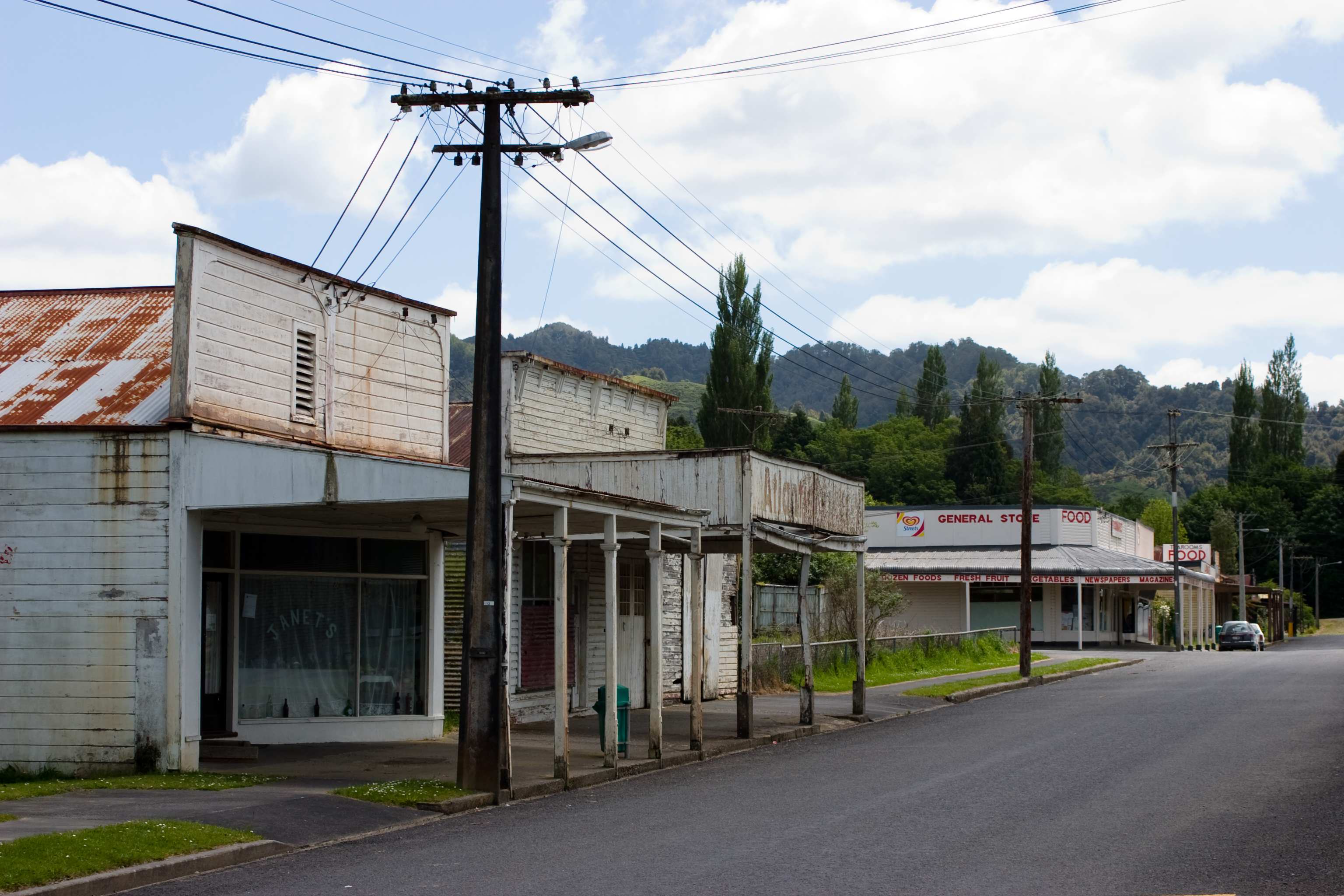 Part of the Ōhura township | |
 | |
| Coordinates: 38°50′35″S 174°58′55″E | |
| Country | New Zealand |
| Region | Manawatū-Whanganui |
| District | Ruapehu District |
| Ward | Ōhura |
| Area | |
| • Total | 3.25 km2 (1.25 sq mi) |
| Population (2018 census)[2] | |
| • Total | 126 |
| • Density | 39/km2 (100/sq mi) |
Background
The New Zealand Ministry for Culture and Heritage gives a translation of "place which is uncovered" for Ōhura.[3] In July 2020, the name of the locality was officially gazetted as Ōhura by the New Zealand Geographic Board.[4]
Ōhura was the centre for coal mining in the region,[5] operating through to circa 1965, where previously the mines, railway network and farming had been major parts of the local industry.
A proud piece of the town is the Ohura Museum which provides a repository for much of the history of Ōhura and the surrounding area.
Te Rukirangi Marae and Papakainga meeting house is located in Ōhura.[6] It is the tribal meeting ground of the Ngāti Maniapoto hapū of Te Rukirangi.[7]
Demographics
Ōhura is defined by Statistics New Zealand as a rural settlement and covers 3.25 km2 (1.25 sq mi). It is part of the wider Otangiwai-Ohura statistical area, which covers 2,011.70 km2 (776.72 sq mi).[1]
The population of Ohura was 126 in the 2018 New Zealand census, a decrease of 3 (-2.3%) since the 2013 census, and a decrease of 36 (-22.2%) since the 2006 census. There were 78 males and 51 females, giving a sex ratio of 1.53 males per female. Ethnicities were 114 people (90.5%) European/Pākehā, 27 (21.4%) Māori, 0 (0.0%) Pacific peoples, and 0 (0.0%) Asian (totals add to more than 100% since people could identify with multiple ethnicities). Of the total population, 12 people (9.5%) were under 15 years old, 12 (9.5%) were 15–29, 60 (47.6%) were 30–64, and 42 (33.3%) were over 65.[2]
Otangiwai-Ohura
| Year | Pop. | ±% p.a. |
|---|---|---|
| 2006 | 1,233 | — |
| 2013 | 1,086 | −1.80% |
| 2018 | 1,020 | −1.25% |
| Source: [8] | ||
Otangiwai-Ohura had a population of 1,020 at the 2018 New Zealand census, a decrease of 66 people (-6.1%) since the 2013 census, and a decrease of 213 people (-17.3%) since the 2006 census. There were 423 households. There were 546 males and 477 females, giving a sex ratio of 1.14 males per female. The median age was 43.4 years (compared with 37.4 years nationally), with 204 people (20.0%) aged under 15 years, 153 (15.0%) aged 15 to 29, 519 (50.9%) aged 30 to 64, and 144 (14.1%) aged 65 or older.
Ethnicities were 84.4% European/Pākehā, 30.3% Māori, 1.5% Pacific peoples, 1.8% Asian, and 0.9% other ethnicities (totals add to more than 100% since people could identify with multiple ethnicities).
The proportion of people born overseas was 8.2%, compared with 27.1% nationally.
Although some people objected to giving their religion, 56.5% had no religion, 29.7% were Christian, 0.6% were Buddhist and 3.2% had other religions.
Of those at least 15 years old, 78 (9.6%) people had a bachelor or higher degree, and 204 (25.0%) people had no formal qualifications. The median income was $27,300, compared with $31,800 nationally. The employment status of those at least 15 was that 453 (55.5%) people were employed full-time, 138 (16.9%) were part-time, and 30 (3.7%) were unemployed.[8]
Education
Ohura Valley Primary is a co-educational state primary school for Year 1 to 8 students,[9] with a roll of 10 as of July 2022.[10]
Notable people
- Frank Glasgow, All Black rugby player[11]
References
- "ArcGIS Web Application". statsnz.maps.arcgis.com. Retrieved 5 March 2021.
- "Age and sex by ethnic group (grouped total response), for census usually resident population counts, 2006, 2013, and 2018 Censuses (urban rural areas)". Statistics New Zealand. Retrieved 5 March 2021.
- "1000 Māori place names". New Zealand Ministry for Culture and Heritage. 6 August 2019.
- "Notice of approved official geographic names" (PDF). New Zealand Gazette. 16 July 2020. Retrieved 18 August 2020.
- Cairns, John (2013). Coal in my blood. ISBN 9780473229290.
- "Māori Maps". maorimaps.com. Te Potiki National Trust.
- "Te Kāhui Māngai directory". tkm.govt.nz. Te Puni Kōkiri.
- "Statistical area 1 dataset for 2018 Census". Statistics New Zealand. March 2020. Otangiwai-Ohura (222300). 2018 Census place summary: Otangiwai-Ohura
- "Ministry of Education School Profile". educationcounts.govt.nz. Ministry of Education.
- "Education Review Office Report". ero.govt.nz. Education Review Office.
- Cooke, Ron (2013). Roll back the years No 6. Taumarunui & Districts historical Society Inc. p. 849. ISBN 978-0-9582984-5-2.
External links
- King Country places - Ōhura, Te Ara - the Encyclopedia of New Zealand
- Ohura website
На других языках
[de] Ohura
Ohura ist ein kleines Dorf im Ruapehu District der Region Manawatū-Whanganui auf der Nordinsel von Neuseeland.- [en] Ōhura
Другой контент может иметь иную лицензию. Перед использованием материалов сайта WikiSort.org внимательно изучите правила лицензирования конкретных элементов наполнения сайта.
WikiSort.org - проект по пересортировке и дополнению контента Википедии