world.wikisort.org - Pays-Bas
Sauwerd (en groningois : Saauwerd) est un village de la commune néerlandaise de Het Hogeland, situé dans la province de Groningue.
Cet article est une ébauche concernant une localité néerlandaise.
Vous pouvez partager vos connaissances en l’améliorant (comment ?) selon les recommandations des projets correspondants.
| Sauwerd Saauwerd | ||||
 Église réformée. | ||||
| Administration | ||||
|---|---|---|---|---|
| Pays | ||||
| Province | ||||
| Commune | Het Hogeland | |||
| Code postal | 9771 | |||
| Démographie | ||||
| Population | 1 325 hab. (2019) | |||
| Géographie | ||||
| Coordonnées | 53° 17′ 36″ nord, 6° 32′ 05″ est | |||
| Localisation | ||||
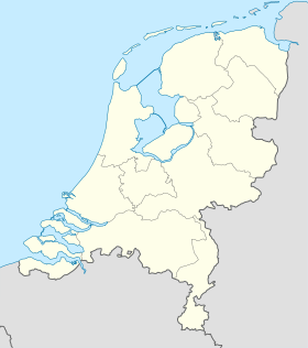
| Géolocalisation sur la carte : Groningue
Géolocalisation sur la carte : Pays-Bas
Géolocalisation sur la carte : Pays-Bas
| ||||
| modifier |
||||


Géographie
Le village est situé à 8 km au nord de Groningue.
Histoire
Sauwerd fait partie de la commune d'Adorp jusqu'en 1990, puis de celle de Winsum avant le , où elle est supprimée et fusionnée avec Bedum, De Marne et Eemsmond pour former la nouvelle commune de Het Hogeland.
Démographie
Le , le village comptait 1 325 habitants[1].
Références
- (nl) Kerncijfers wijken en buurten 2019, Centraal Bureau voor de Statistiek
 Portail des Pays-Bas
На других языках
[de] Sauwerd
Sauwerd (Gronings Saauwerd) ist ein Dorf in der Gemeinde Het Hogeland in der niederländischen Provinz Groningen.[en] Sauwerd
Sauwerd is a village in the municipality of Het Hogeland, Groningen, Netherlands. Until the local government reorganization of 1990 the village was the head of the former municipality of Adorp.- [fr] Sauwerd
Текст в блоке "Читать" взят с сайта "Википедия" и доступен по лицензии Creative Commons Attribution-ShareAlike; в отдельных случаях могут действовать дополнительные условия.
Другой контент может иметь иную лицензию. Перед использованием материалов сайта WikiSort.org внимательно изучите правила лицензирования конкретных элементов наполнения сайта.
Другой контент может иметь иную лицензию. Перед использованием материалов сайта WikiSort.org внимательно изучите правила лицензирования конкретных элементов наполнения сайта.
2019-2026
WikiSort.org - проект по пересортировке и дополнению контента Википедии
WikiSort.org - проект по пересортировке и дополнению контента Википедии