world.wikisort.org - Netherlands
Zwartewaal is a village in the Dutch province of South Holland, The Netherlands. It is a part of the municipality of Brielle and lies about 5 km south of Maassluis.
Zwartewaal | |
|---|---|
Village | |
 Warehouse in Zwartewaal | |
 Coat of arms | |
 Zwartewaal Location in the province of South Holland in the Netherlands  Zwartewaal Location in the Netherlands | |
| Coordinates: 51°53′N 4°13′E | |
| Country | Netherlands |
| Province | South Holland |
| Municipality | Brielle |
| Area | |
| • Total | 9.52 km2 (3.68 sq mi) |
| Elevation | 0.2 m (0.7 ft) |
| Population (2021)[1] | |
| • Total | 1,905 |
| • Density | 200/km2 (520/sq mi) |
| Time zone | UTC+1 (CET) |
| • Summer (DST) | UTC+2 (CEST) |
| Postal code | 3238[1] |
| Dialing code | 0181 |
History
The village was first mentioned in the middle of the 13th century as "ten Zwarten Wale", and means "black (water) pond created after a dike breech".[3] Zwartewaal is dike village which developed after 1180 when the Zwartewaal polder was created. A fishing harbour was constructed outside the dike.[4] On 5 July 1351. the Battle of Zwartewaal was fought where William I, Duke of Bavaria defeated his mother and became count of Holland. Mother and son made peace in 1354.[5]
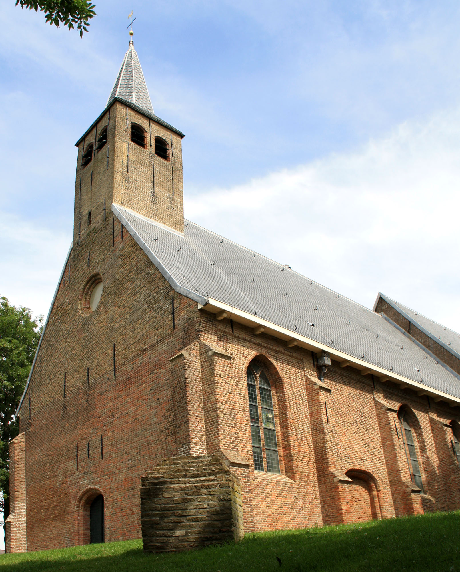
The Dutch Reformed church is a single aisled church from the 15th century. The tower was built in 1597.[5] The church is built on a terp (artificial hill) and is located outside of the village centre, because the village relocated due to flooding.[5]
Zwartewaal was home to 1,006 people in 1840.[5] It was a separate municipality between 1817 and 1980, when it became part of Brielle.[6]
Gallery
 Dutch Reformed church
 Zwartewaal and surroundings from Gemeente Atlas van Nederland by J. Kuyper, 1867

References
- "Kerncijfers wijken en buurten 2021". Central Bureau of Statistics. Retrieved 3 May 2022.
- "Postcodetool for 3238AA". Actueel Hoogtebestand Nederland (in Dutch). Het Waterschapshuis. Retrieved 3 May 2022.
- "Zwartewaal - (geografische naam)". Etymologiebank (in Dutch). Retrieved 3 May 2022.
- Ronald Stenvert & Sabine Broekhoven (2004). "Zwartewaal" (in Dutch). Zwolle: Waanders. ISBN 90 400 9034 3. Retrieved 3 May 2022.
- "Zwartewaal". Plaatsengids (in Dutch). Retrieved 3 May 2022.
- Ad van der Meer and Onno Boonstra, "Repertorium van Nederlandse gemeenten", KNAW, 2006. "Repertorium van Nederlandse gemeenten 1812-2006". Archived from the original on February 20, 2007. Retrieved December 3, 2009.
This South Holland location article is a stub. You can help Wikipedia by expanding it. |
Другой контент может иметь иную лицензию. Перед использованием материалов сайта WikiSort.org внимательно изучите правила лицензирования конкретных элементов наполнения сайта.
WikiSort.org - проект по пересортировке и дополнению контента Википедии