world.wikisort.org - Netherlands
Welsum is a village on the left bank of the river IJssel in the present municipality of Olst-Wijhe in the Dutch province of Overijssel.
Welsum | |
|---|---|
 Houdt Braef Stant – the mill in Welsum, built in 1856 | |
 Welsum Location in the province of Overijssel in the Netherlands  Welsum Welsum (Netherlands) | |
| Coordinates: 52°20′09″N 6°05′28″E | |
| Country | Netherlands |
| Province | Overijssel |
| Municipality | Olst-Wijhe |
| Area | |
| • Total | 8.89 km2 (3.43 sq mi) |
| Elevation | 5 m (16 ft) |
| Population (2021)[1] | |
| • Total | 625 |
| • Density | 70/km2 (180/sq mi) |
| Time zone | UTC+1 (CET) |
| • Summer (DST) | UTC+2 (CEST) |
| Postal code | 8196[1] |
| Dialing code | 0570 |
The village is the source of the Welsummer chicken breed. In 2001, a number of farms culled their flocks in connection with the outbreak of foot-and-mouth disease.
The earliest existing written mention of the village (as Wilsum, kerspel Olst) dates from 1295.[3] The tower of the Protestant church was built around 1475. The village's flour mill, Houdt Braef Stant, dates to 1856, with restorations in 1963 (using internal parts from the mill Wippe in Hellendoorn) and 1986. It is currently being used as a dwelling.
Gallery
 Farm in Welsum
 Church of Welsum
 Farm in Welsum
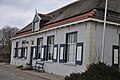
 Former toll house on the dike


References
- "Kerncijfers wijken en buurten 2021". Central Bureau of Statistics. Retrieved 13 April 2022.
- "Postcodetool for 8196KA". Actueel Hoogtebestand Nederland (in Dutch). Het Waterschapshuis. Retrieved 13 April 2022.
- (in Dutch) Welsum: Historie, Retrieved April 20, 2012.
External links
 Media related to Welsum at Wikimedia Commons
This Overijssel location article is a stub. You can help Wikipedia by expanding it. |
Текст в блоке "Читать" взят с сайта "Википедия" и доступен по лицензии Creative Commons Attribution-ShareAlike; в отдельных случаях могут действовать дополнительные условия.
Другой контент может иметь иную лицензию. Перед использованием материалов сайта WikiSort.org внимательно изучите правила лицензирования конкретных элементов наполнения сайта.
Другой контент может иметь иную лицензию. Перед использованием материалов сайта WikiSort.org внимательно изучите правила лицензирования конкретных элементов наполнения сайта.
2019-2026
WikiSort.org - проект по пересортировке и дополнению контента Википедии
WikiSort.org - проект по пересортировке и дополнению контента Википедии