world.wikisort.org - Netherlands
Rockanje is a village in the Dutch province of South Holland. It is a part of the municipality of Westvoorne, and lies about 7 km northwest of Hellevoetsluis.
Rockanje | |
|---|---|
Village | |
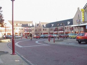 Village centre of Rockanje | |
 Flag  Coat of arms | |
 | |
 The village centre (dark green) and the statistical district (light green) of Rockanje in the municipality of Westvoorne. | |
| Coordinates: 51°52′14″N 4°4′8″E | |
| Country | Netherlands |
| Province | South Holland |
| Municipality | Westvoorne |
| Area | |
| • Total | 30.03 km2 (11.59 sq mi) |
| • Land | 29.75 km2 (11.49 sq mi) |
| • Water | 0.26 km2 (0.10 sq mi) |
| Population (1 January 2005) | |
| • Total | 6,560 |
| • Density | 220/km2 (570/sq mi) |
| Time zone | UTC+1 (CET) |
| • Summer (DST) | UTC+2 (CEST) |
| Postal code | 3235 |
In 2001, the village of Rockanje had 4805 inhabitants. The built-up area of the village was 1.2 km², and contained 2004 residences.[1] The statistical area "Rockanje", which also can include the peripheral parts of the village, as well as the surrounding countryside, has a population of around 5710.[2]
Rockanje was a separate municipality until 1980, when it became part of Westvoorne.[3]

References
- Statistics Netherlands (CBS), Bevolkingskernen in Nederland 2001. (Statistics are for the continuous built-up area).
- Statistics Netherlands (CBS), Statline: Kerncijfers wijken en buurten 2003-2005. As of January 1, 2005.
- Ad van der Meer and Onno Boonstra, Repertorium van Nederlandse gemeenten, KNAW, 2011.
Authority control | |
|---|---|
| General |
|
| National libraries | |
| Other |
|
This South Holland location article is a stub. You can help Wikipedia by expanding it. |
Текст в блоке "Читать" взят с сайта "Википедия" и доступен по лицензии Creative Commons Attribution-ShareAlike; в отдельных случаях могут действовать дополнительные условия.
Другой контент может иметь иную лицензию. Перед использованием материалов сайта WikiSort.org внимательно изучите правила лицензирования конкретных элементов наполнения сайта.
Другой контент может иметь иную лицензию. Перед использованием материалов сайта WikiSort.org внимательно изучите правила лицензирования конкретных элементов наполнения сайта.
2019-2026
WikiSort.org - проект по пересортировке и дополнению контента Википедии
WikiSort.org - проект по пересортировке и дополнению контента Википедии