world.wikisort.org - Netherlands
De Lier (Dutch pronunciation: [də ˈliːr]) is a village in the Dutch province of South Holland. It is a part of the municipality of Westland, and lies about 5 km north of Maassluis. It also lies about 6 feet (1.8 m) below sea level.
De Lier | |
|---|---|
 Coat of arms | |
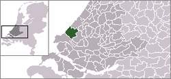
 The village centre (dark green) and the statistical district (light green) of De Lier in the municipality of Westland. | |
 | |
| Coordinates: 51°58′25″N 4°15′00″E | |
| Country | Netherlands |
| Province | South Holland |
| Municipality | Westland |
| Population | 11.925 |
| Major roads | N223 |
| Website | http://www.gemeentewestland.nl |
The village of De Lier obtained its name from the name of an old river called Lee (De Lier).
De Lier used to be a separate municipality. On 26 March 1963 it was granted their coat of arms and on 14 April 1965, it adopted their modern-day flag. On 1 January 2004, it merged with Naaldwijk, 's-Gravenzande, Monster, and Wateringen to form the municipality of Westland. The former municipality covered an area of 8.93 square kilometres.
In 2001, De Lier had 9415 inhabitants. In 2003, De Lier had 11,400 inhabitants. The built-up area of the village was 2.2 km², and contained 3494 residences.[1] The statistical area "De Lier", which can also include the peripheral parts of the village as well as the surrounding countryside, has a population of around 11,470.[2]
Nearby quarters
- Nieuwe Tuinen 1.6 nautical miles (3.0 km) west
- Blaker 1-nautical-mile (1.9 km) north
- Lierhand 1.2 nautical miles (2.2 km) north
- Oostbuurt 1.2 nautical miles (2.2 km) north
- Gaag 1-nautical-mile (1.9 km) south
 Main street of De Lier.
![The Lierse Dom [nl]](//upload.wikimedia.org/wikipedia/commons/thumb/7/70/De_Lier%2C_kerk1_foto1_2009-08-23_16.26.JPG/90px-De_Lier%2C_kerk1_foto1_2009-08-23_16.26.JPG) The Lierse Dom
The Lierse Dom

![The Lierse Dom [nl]](http://upload.wikimedia.org/wikipedia/commons/7/70/De_Lier%2C_kerk1_foto1_2009-08-23_16.26.JPG)
References
- Statistics Netherlands (CBS), Bevolkingskernen in Nederland 2001 Archived March 19, 2006, at the Wayback Machine. (Statistics are for the continuous built-up area).
- Statistics Netherlands (CBS), Statline: Kerncijfers wijken en buurten 2003-2005 Archived 1999-04-27 at the Wayback Machine. As of 1 January 2005.
External links
 Media related to De Lier at Wikimedia Commons
- www.crwflags.com
- www.fallingrain.com
| Authority control |
|
|---|
This South Holland location article is a stub. You can help Wikipedia by expanding it. |
Другой контент может иметь иную лицензию. Перед использованием материалов сайта WikiSort.org внимательно изучите правила лицензирования конкретных элементов наполнения сайта.
WikiSort.org - проект по пересортировке и дополнению контента Википедии