world.wikisort.org - Netherlands
Achterberg is a village in the Dutch province of Utrecht. It is part of the municipality of Rhenen and it lies about 5 km west of Wageningen.
Achterberg | |
|---|---|
Village | |
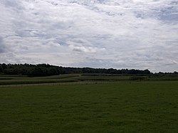
 Corn fields in the direction of Rhenen, seen from Achterberg | |
 Achterberg Location in the Netherlands  Achterberg Achterberg (Netherlands) | |
| Coordinates: 51°58′18″N 5°35′8″E | |
| Country | Netherlands |
| Province | Utrecht |
| Municipality | Rhenen |
| Area | |
| • Total | 0.38 km2 (0.15 sq mi) |
| Elevation | 15 m (49 ft) |
| Population (2021)[1] | |
| • Total | 1,670 |
| • Density | 4,400/km2 (11,000/sq mi) |
| Time zone | UTC+1 (CET) |
| • Summer (DST) | UTC+2 (CEST) |
| Postal code | 3911[1] |
| Dialing code | 0317 |
The village was first mentioned in 1417 as Achterbergh, and means "(settlement) behind the hill".[3] Achterberg developed as an esdorp on the northern flank of a hill near castle Ter Horst. The castle was built in 1160 and demolished in 1528.[4] In 1840, Achterberg was home to 1,043 people. In 1940, the village was the scene of heavy fighting during the Battle of the Grebbeberg. The grist mill Crescendo was built in 1886 and destroyed in 1945 during a battle.[5]
Gallery
- Estate Stuivenes
- Former castle Ter Horst (16th century)
- Church of Achterberg
- Railway bridge
References
- "Kerncijfers wijken en buurten 2021". Central Bureau of Statistics. Retrieved 27 March 2022.
- "Postcodetool for 3911AA". Actueel Hoogtebestand Nederland (in Dutch). Het Waterschapshuis. Retrieved 27 March 2022.
- "Achterberg - (geografische naam)". Etymologiebank (in Dutch). Retrieved 27 March 2022.
- Ronald Stenvert & Chris Kolman (1996). "Achterberg" (in Dutch). Zwolle: Waanders. ISBN 90 400 9757 7. Retrieved 26 March 2022.
- "Achterberg". Plaatsengids (in Dutch). Retrieved 27 March 2022.
| Wikimedia Commons has media related to Achterberg. |
Текст в блоке "Читать" взят с сайта "Википедия" и доступен по лицензии Creative Commons Attribution-ShareAlike; в отдельных случаях могут действовать дополнительные условия.
Другой контент может иметь иную лицензию. Перед использованием материалов сайта WikiSort.org внимательно изучите правила лицензирования конкретных элементов наполнения сайта.
Другой контент может иметь иную лицензию. Перед использованием материалов сайта WikiSort.org внимательно изучите правила лицензирования конкретных элементов наполнения сайта.
2019-2025
WikiSort.org - проект по пересортировке и дополнению контента Википедии
WikiSort.org - проект по пересортировке и дополнению контента Википедии


