world.wikisort.org - Nepal
Muga is a village development committee in Dhankuta District in the Kosi Zone of eastern Nepal. At the time of the 1991 Nepal census it had a population of 4101 people living in 738 individual households.[1]
Muga
मुगा | |
|---|---|
Village development committee | |
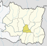
 Muga Location in Nepal | |
| Coordinates: 27.04°N 87.21°E | |
| Country | |
| Zone | Kosi Zone |
| District | Dhankuta District |
| Population (1991) | |
| • Total | 4,101 |
| Time zone | UTC+5:45 (Nepal Time) |
| Postal code | 56807 |
| Area code(s) | 026 |
References
- "Nepal Census 2001". Nepal's Village Development Committees. Digital Himalaya. Retrieved 24 November 2008.
Dhankuta District | ||
|---|---|---|
Headquarter: Dhankuta Municipality | ||
| Rural Municipalities |
|  |
| Municipalities |
| |
This article about a location in the Dhankuta District of Nepal is a stub. You can help Wikipedia by expanding it. |
Текст в блоке "Читать" взят с сайта "Википедия" и доступен по лицензии Creative Commons Attribution-ShareAlike; в отдельных случаях могут действовать дополнительные условия.
Другой контент может иметь иную лицензию. Перед использованием материалов сайта WikiSort.org внимательно изучите правила лицензирования конкретных элементов наполнения сайта.
Другой контент может иметь иную лицензию. Перед использованием материалов сайта WikiSort.org внимательно изучите правила лицензирования конкретных элементов наполнения сайта.
2019-2026
WikiSort.org - проект по пересортировке и дополнению контента Википедии
WikiSort.org - проект по пересортировке и дополнению контента Википедии