world.wikisort.org - Nepal
Darkha is a village development committee in Dhading District in the Bagmati Zone of central Nepal. At the time of the 1991 Nepal census it had a population of 4979 and had 910 houses in it.[1]
Darkha
दार्खा | |
|---|---|
Village development committee | |
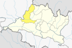
 Darkha Location in Nepal | |
| Coordinates: 28.07°N 85.01°E | |
| Country | |
| Zone | Bagmati Zone |
| District | Dhading District |
| Population (1991) | |
| • Total | 4,979 |
| • Religions | Buddhist |
| Time zone | UTC+5:45 (Nepal Time) |
References
- "Nepal Census 2001". Nepal's Village Development Committees. Digital Himalaya. Archived from the original on 2008-10-12. Retrieved 2008-08-24.
Dhading District | ||
|---|---|---|
Headquarter: Dhading Besi | ||
| Gaunpalika |
|  |
| Municipalities |
| |
Darkha is verry beauti of natural. and darkha is east border of satyadevi and aakhu border in the south,jharlang border is west fraom darkha we can see beauty schene of ganesh himal. such this is nice v.d.c.
This article about a location in the Dhading District of Nepal is a stub. You can help Wikipedia by expanding it. |
Текст в блоке "Читать" взят с сайта "Википедия" и доступен по лицензии Creative Commons Attribution-ShareAlike; в отдельных случаях могут действовать дополнительные условия.
Другой контент может иметь иную лицензию. Перед использованием материалов сайта WikiSort.org внимательно изучите правила лицензирования конкретных элементов наполнения сайта.
Другой контент может иметь иную лицензию. Перед использованием материалов сайта WikiSort.org внимательно изучите правила лицензирования конкретных элементов наполнения сайта.
2019-2026
WikiSort.org - проект по пересортировке и дополнению контента Википедии
WikiSort.org - проект по пересортировке и дополнению контента Википедии