world.wikisort.org - Nepal
Baniyani (Nepali: बनियानी) is a Village Development Committee in Jhapa District in the Province No. 1 of south-eastern Nepal. At the time of the 1991 Nepal census it had a population of 5043 people residing in 985 individual households.[1] Laxmi Higher Secondary School, Baniyani Health-Post, and an Armed-Force Camp are located in the vicinity. Mechi River flows to the east on the border of Nepal and India.
Baniyani | |
|---|---|
Village Development Committee | |
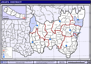 Map of the Village Development Committees in Jhapa District | |
 Baniyani Location in Nepal | |
| Coordinates: | |
| Country | |
| Province | Province No. 1 |
| District | Jhapa District |
| Population (1991) | |
| • Total | 5,043 |
| Time zone | UTC+5:45 (Nepal Time) |
Demographics
Many ethnic groups live in the region, such as: Rai, Newar, Tamang, Limbu, Meche, Koche, Rajbanshi, Gangain, Muslim, and Gaine.
References
- "Nepal Census 2001". Nepal's Village Development Committees. Digital Himalaya. Archived from the original on 12 October 2008. Retrieved 24 November 2008.
Jhapa District | ||
|---|---|---|
Headquarter: Bhadrapur | ||
| Rural Municipalities |
|  |
| Municipalities |
| |
This article about a location in the Jhapa District of Nepal is a stub. You can help Wikipedia by expanding it. |
Текст в блоке "Читать" взят с сайта "Википедия" и доступен по лицензии Creative Commons Attribution-ShareAlike; в отдельных случаях могут действовать дополнительные условия.
Другой контент может иметь иную лицензию. Перед использованием материалов сайта WikiSort.org внимательно изучите правила лицензирования конкретных элементов наполнения сайта.
Другой контент может иметь иную лицензию. Перед использованием материалов сайта WikiSort.org внимательно изучите правила лицензирования конкретных элементов наполнения сайта.
2019-2026
WikiSort.org - проект по пересортировке и дополнению контента Википедии
WikiSort.org - проект по пересортировке и дополнению контента Википедии