world.wikisort.org - Messico
Vetagrande è una municipalità dello stato di Zacatecas, nel Messico centrale, il cui capoluogo è la località omonima.
| Vetagrande comune | |
|---|---|
| (ES) Vetagrande | |
 | |
| Localizzazione | |
| Stato | |
| Stato federato | |
| Territorio | |
| Coordinate | 22°49′00″N 102°57′33″W |
| Altitudine | 2 226 m s.l.m. |
| Superficie | 161,42 km² |
| Abitanti | 9 353 (2010) |
| Densità | 57,94 ab./km² |
| Altre informazioni | |
| Fuso orario | UTC-6 |
| Cartografia | |
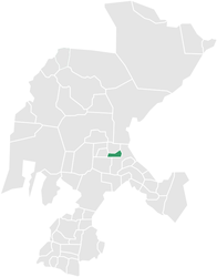
 Vetagrande | |
 | |
Conta 9.353 abitanti (2010) e ha una estensione di 161,42 km².
Altri progetti
 Wikimedia Commons contiene immagini o altri file su Vetagrande
Collegamenti esterni
На других языках
[en] Vetagrande
Vetagrande Municipality is one of 58 municipalities of Zacatecas, Mexico. It has an area of 142 km² occupying 0.18% of state territory. The municipal seat is located in the town of the same name. Another town of this municipality is Llano de las Vírgenes.[es] Municipio de Vetagrande
El municipio de Vetagrande es uno de los 58 municipios del estado de Zacatecas, México. Tiene una superficie de 142 km² ocupando el 0.18% del territorio del estado. La cabecera municipal se encuentra en la localidad de Vetagrande.- [it] Vetagrande
[ru] Ветагранде (муниципалитет)
Ветагранде (исп. Vetagrande) — населённый пункт и муниципалитет в Мексике, входит в штат Сакатекас. Население 8358 человек.Текст в блоке "Читать" взят с сайта "Википедия" и доступен по лицензии Creative Commons Attribution-ShareAlike; в отдельных случаях могут действовать дополнительные условия.
Другой контент может иметь иную лицензию. Перед использованием материалов сайта WikiSort.org внимательно изучите правила лицензирования конкретных элементов наполнения сайта.
Другой контент может иметь иную лицензию. Перед использованием материалов сайта WikiSort.org внимательно изучите правила лицензирования конкретных элементов наполнения сайта.
2019-2026
WikiSort.org - проект по пересортировке и дополнению контента Википедии
WikiSort.org - проект по пересортировке и дополнению контента Википедии