world.wikisort.org - Japan
Ōhara (大原町, Ōhara-chō) was a town located in Aida District, Okayama Prefecture, Japan.
This article needs additional citations for verification. (February 2022) |
Ōhara
大原町 | |
|---|---|
Former municipality | |
 Former Ōhara town hall | |
 Ōhara Location in Japan | |
| Coordinates: 35°7′14.45″N 134°19′33.9″E | |
| Country | Japan |
| Region | Chūgoku |
| Prefecture | Okayama Prefecture |
| District | Aida |
| Merged | March 31, 2005 (now part of Mimasaka) |
| Area | |
| • Total | 54.48 km2 (21.03 sq mi) |
| Population (2003) | |
| • Total | 4,630 |
| • Density | 84.99/km2 (220.1/sq mi) |
| Time zone | UTC+09:00 (JST) |
| Symbols | |
| Flower | Lilium japonicum |
| Tree | Zelkova serrata |

As of 2003, the town had an estimated population of 4,630 and a density of 84.99 persons per km². The total area was 54.48 km².
On March 31, 2005, Ōhara, along with the towns of Mimasaka, Aida and Sakutō, the village of Higashiawakura (all from Aida District), and the town of Katsuta (from Katsuta District), was merged to create the city of Mimasaka.
Geography
Adjoining municipalities
- Okayama Prefecture
- Sakutō
- Nishiawakura
- Higashiawakura
- Katsuta
- Hyōgo Prefecture
- Sayō
Education
- Ōhara Elementary School
- Ōhara Junior High School
- Okayama Prefectural Ōhara High School (Closure in 2006)
Transportation
Railways
- Chizu Express
- Chizu Line
- Miyamoto Musashi Station - Ōhara Station
- Chizu Line
Road
- National highways:
- Route 373
- Route 429
- Prefectural roads:
- Okayama Prefectural Route 5 (Sakutō-Ōhara)
- Okayama Prefectural Route 240 (Shimoshō-Sayō)
- Okayama Prefectural Route 357 (Kajinami-Tateishi)
Notable places and events
- Village of Miyamoto Musashi
- Main stone of Miyamoto Musashi Temple
- Miyamoto Musashi's grave next to that of his parents
- Ōhara-shuku (Shukuba)
 Village of Miyamoto Musashi
 Main stone of Miyamoto Musashi Temple
 Statue of Miyamoto Musashi
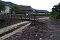
 Ōhara-shuku


References
External links
- Official website of Mimasaka in Japanese
This Okayama Prefecture location article is a stub. You can help Wikipedia by expanding it. |
Текст в блоке "Читать" взят с сайта "Википедия" и доступен по лицензии Creative Commons Attribution-ShareAlike; в отдельных случаях могут действовать дополнительные условия.
Другой контент может иметь иную лицензию. Перед использованием материалов сайта WikiSort.org внимательно изучите правила лицензирования конкретных элементов наполнения сайта.
Другой контент может иметь иную лицензию. Перед использованием материалов сайта WikiSort.org внимательно изучите правила лицензирования конкретных элементов наполнения сайта.
2019-2026
WikiSort.org - проект по пересортировке и дополнению контента Википедии
WikiSort.org - проект по пересортировке и дополнению контента Википедии