world.wikisort.org - Japan
Shin-Kamigotō (新上五島町, Shin-Kamigotō-chō) is a town located in Minami-Matsuura District, Nagasaki Prefecture, Japan.
This article needs additional citations for verification. (December 2009) |
Shin-Kamigotō
新上五島町 | |
|---|---|
Town | |
 Shin-Kamigotō Town Office | |
 Flag  Seal | |
 Location of Shin-Kamigotō in Nagasaki Prefecture | |
 Shin-Kamigotō Location in Japan | |
| Coordinates: 32°59′4″N 129°4′24″E | |
| Country | Japan |
| Region | Kyushu |
| Prefecture | Nagasaki Prefecture |
| District | Minami-Matsuura |
| Area | |
| • Total | 213.98 km2 (82.62 sq mi) |
| Population (March 31, 2017) | |
| • Total | 19,866 |
| • Density | 93/km2 (240/sq mi) |
| Time zone | UTC+09:00 (JST) |
| Climate | Cfa |
| Website | official |
| Symbols | |
| Bird | Japanese white-eye |
| Flower | Camellia |
| Tree | Camellia |
The town was established on August 1, 2004 after the merger of the towns of Arikawa, Kamigotō, Narao, Shin-Uonome and Wakamatsu, all from Minami-Matsuura District. It occupies the two main islands of Nakadōri and Wakamatsu, which are connected by Wakamatsu Oohashi ("Wakamatsu Great Bridge") via the small, unpopulated islet of Kaminakajima (上中島), as well as several smaller islands, including the populated islands of Arifuku, Hinoshima, Ryōzegaura, Kashiragashima, and Kirinoko. Wakamatsu Island is connected at its northwestern extremity to Ryōzegaura Island by the Ryōzegaura Bridge, and Ryōzegaura Island is further linked with the islands of Arifuku and Hinoshima by breakwaters that allow traffic of automobiles. Kashiragashima Oohashi connects the eastern end of the main island of Nakadōri with Kashiragashima, on which the famous Kashiragashima Church and the defunct Kamigotō Airport are located.
The islands that comprise the territory of Shin-Kamigotō Town also form the northeastern half of the Gotō Islands archipelago, which is the origin of the name Kamigotō (literally, "Upper Five Islands"), in which Gotō ("Five Islands") is the name of the entire archipelago, and Kami- ("Upper") refers to the fact that this half of the archipelago is located closer to the Japanese capital relative to the southwestern half. The prefix Shin- (新) at the beginning of the town's name means "new," so its full name may be translated literally to English as "New Upper Five Islands Town," though the name may be interpreted to refer to the town as a new and expanded version of the former Kamigotō Town, which was centered on the port of Aokata on the western side of the middle of Nakadōri Island.
As of March 31, 2017, the town has an estimated population of 19,866[1] and a density of 93 persons per km2. The total area is 213.98 km2.
Geography
Climate
Shin-Kamigotō has the typical humid subtropical climate (Köppen Cfa) of Kyūshū, characterized by mild winters and long, hot, and humid summers. The average annual temperature in Shin-Kamigotō is 17.1 °C (62.8 °F). The average annual rainfall is 2,192.3 mm (86.31 in) with July as the wettest month. The temperatures are highest on average in August, at around 27.4 °C (81.3 °F), and lowest in January, at around 7.7 °C (45.9 °F).[2] Its record high is 36.4 °C (97.5 °F), reached on 21 August 2013, and its record low is −4.7 °C (23.5 °F), reached on 23 January 1981.[3]
| Climate data for Arikawa, Shin-Kamigotō (1991−2020 normals, extremes 1977−present) | |||||||||||||
|---|---|---|---|---|---|---|---|---|---|---|---|---|---|
| Month | Jan | Feb | Mar | Apr | May | Jun | Jul | Aug | Sep | Oct | Nov | Dec | Year |
| Record high °C (°F) | 20.4 (68.7) |
23.3 (73.9) |
23.1 (73.6) |
28.5 (83.3) |
29.0 (84.2) |
32.1 (89.8) |
34.6 (94.3) |
36.4 (97.5) |
33.7 (92.7) |
31.6 (88.9) |
25.3 (77.5) |
24.2 (75.6) |
36.4 (97.5) |
| Average high °C (°F) | 10.5 (50.9) |
11.5 (52.7) |
14.5 (58.1) |
18.8 (65.8) |
22.7 (72.9) |
25.5 (77.9) |
29.7 (85.5) |
31.0 (87.8) |
27.5 (81.5) |
23.2 (73.8) |
18.3 (64.9) |
13.1 (55.6) |
20.5 (68.9) |
| Daily mean °C (°F) | 7.7 (45.9) |
8.3 (46.9) |
11.0 (51.8) |
14.9 (58.8) |
18.8 (65.8) |
22.1 (71.8) |
26.4 (79.5) |
27.4 (81.3) |
24.3 (75.7) |
19.8 (67.6) |
14.8 (58.6) |
9.9 (49.8) |
17.1 (62.8) |
| Average low °C (°F) | 4.6 (40.3) |
4.8 (40.6) |
7.2 (45.0) |
10.9 (51.6) |
15.0 (59.0) |
19.2 (66.6) |
23.9 (75.0) |
24.6 (76.3) |
21.5 (70.7) |
16.5 (61.7) |
11.1 (52.0) |
6.5 (43.7) |
13.8 (56.9) |
| Record low °C (°F) | −4.7 (23.5) |
−4.5 (23.9) |
−2.4 (27.7) |
−0.1 (31.8) |
5.8 (42.4) |
9.6 (49.3) |
15.5 (59.9) |
17.2 (63.0) |
13.1 (55.6) |
4.2 (39.6) |
2.3 (36.1) |
−2.9 (26.8) |
−4.7 (23.5) |
| Average precipitation mm (inches) | 83.2 (3.28) |
100.1 (3.94) |
147.6 (5.81) |
196.9 (7.75) |
199.0 (7.83) |
306.0 (12.05) |
316.3 (12.45) |
251.3 (9.89) |
242.1 (9.53) |
121.8 (4.80) |
118.6 (4.67) |
85.1 (3.35) |
2,192.3 (86.31) |
| Average precipitation days (≥ 1.0 mm) | 9.4 | 9.0 | 10.7 | 9.6 | 9.4 | 12.2 | 11.4 | 10.3 | 9.5 | 6.8 | 8.3 | 9.0 | 115.6 |
| Mean monthly sunshine hours | 77.8 | 108.0 | 152.8 | 179.5 | 190.9 | 126.9 | 162.5 | 195.4 | 160.9 | 170.8 | 121.5 | 85.8 | 1,734.5 |
| Source: Japan Meteorological Agency[3][2] | |||||||||||||
Population

| Population distribution by age (2005) | Population distribution by gender (2005) |
|---|---|
Shinkamigotō | Female |
Japan | Male |
Changes in Population
| Year | Population |
|---|---|
| 1970 | 46,762 |
| 1975 | 40,867 |
| 1980 | 38,140 |
| 1985 | 36,005 |
| 1990 | 32,123 |
| 1995 | 29,845 |
| 2000 | 27,559 |
| 2005 | 25,039 |
| 2010 | 22,076 |
| 2012 | 21,183 |
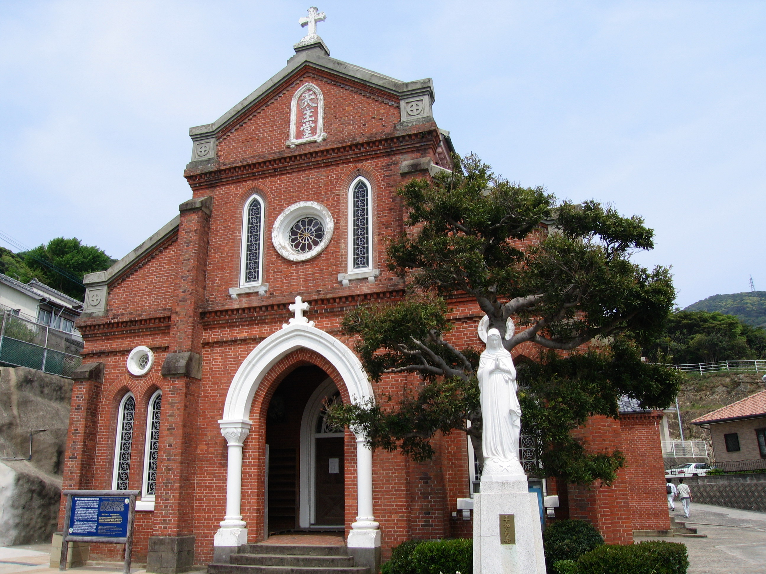
 Aosagaura Church
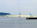 Oil Storage Company
 Whale Bone Shrine
 Hifumi Waterfall
 Yagatame Park
 View of Koenoura Bay
 Great Tree of Akou
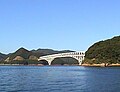 Wakamatsu Great Bridge
 Wakamatsu Strait & Great Bridge from Ryūkanzan


References
- "Official website of Shin-Kamigotō Town" (in Japanese). Japan: Shin-Kamigotō Town. Retrieved 26 April 2017.
- 気象庁 / 平年値(年・月ごとの値). JMA. Retrieved March 30, 2022.
- 観測史上1~10位の値(年間を通じての値). JMA. Retrieved March 30, 2022.
External links
 Media related to Shinkamigotō, Nagasaki at Wikimedia Commons
- Shinkamigotō official website (in Japanese)
- English Tourist Information Website (in English)
Nagasaki (capital) | ||
| Core cities |
| |
| Cities | ||
| Districts |
| |
List of mergers in Nagasaki Prefecture | ||
| Authority control |
|
|---|
 | This Nagasaki Prefecture location article is a stub. You can help Wikipedia by expanding it. |
На других языках
- [en] Shin-Kamigotō
[ru] Синкамигото
Синкамигото (яп. 新上五島町 Синкамигото:-тё:) — посёлок в Японии, находящийся в уезде Минамимацуура префектуры Нагасаки. Площадь посёлка составляет 213,98 км²[1], население — 20 158 человек (1 июля 2014)[2], плотность населения — 94,21 чел./км².Другой контент может иметь иную лицензию. Перед использованием материалов сайта WikiSort.org внимательно изучите правила лицензирования конкретных элементов наполнения сайта.
WikiSort.org - проект по пересортировке и дополнению контента Википедии