world.wikisort.org - Japan
Kaita (海田町, Kaita-chō) is a town located in Aki District, Hiroshima Prefecture, Japan.[1] As of April 1, 2020, the town has an estimated population of 29,636 and a population density of 2,100 persons per km². The total area is 13.81 km².
 | This article may be expanded with text translated from the corresponding article in Japanese. Click [show] for important translation instructions.
|
Kaita
海田町 | |
|---|---|
Town | |
 Flag  Emblem | |
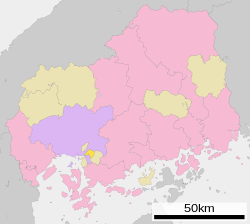 Location of Kaita in Hiroshima Prefecture | |
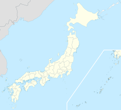  Kaita Location in Japan | |
| Coordinates: 34°22′N 132°32′E | |
| Country | Japan |
| Region | Chūgoku San'yō |
| Prefecture | Hiroshima Prefecture |
| District | Aki |
| Area | |
| • Total | 13.81 km2 (5.33 sq mi) |
| Population (April 1, 2017) | |
| • Total | 29,082 |
| • Density | 2,100/km2 (5,500/sq mi) |
| Time zone | UTC+09:00 (JST) |
| Website | www |
References
- "広島県". 広島県公式ホームページ (in Japanese). Retrieved 2022-10-21.
External links
 Media related to Kaita, Hiroshima at Wikimedia Commons
- Kaita official site (in Japanese)

Authority control | |
|---|---|
| General | |
| National libraries | |

 | This Hiroshima Prefecture location article is a stub. You can help Wikipedia by expanding it. |
На других языках
- [en] Kaita, Hiroshima
[es] Kaita (Hiroshima)
Kaita (海田町, Kaita-chō?) es un pueblo localizado en la prefectura de Hiroshima, Japón. En junio de 2019 tenía una población estimada de 29.431 habitantes y una densidad de población de 2.134 personas por km². Su área total es de 13,79 km².[ru] Кайта (посёлок)
Кайта (яп. 海田町 Кайта-тё:) — посёлок в Японии, находящийся в уезде Аки префектуры Хиросима. Площадь посёлка составляет 13,81 км²[1], население — 28 376 человек (1 июля 2014)[2], плотность населения — 2054,74 чел./км².Текст в блоке "Читать" взят с сайта "Википедия" и доступен по лицензии Creative Commons Attribution-ShareAlike; в отдельных случаях могут действовать дополнительные условия.
Другой контент может иметь иную лицензию. Перед использованием материалов сайта WikiSort.org внимательно изучите правила лицензирования конкретных элементов наполнения сайта.
Другой контент может иметь иную лицензию. Перед использованием материалов сайта WikiSort.org внимательно изучите правила лицензирования конкретных элементов наполнения сайта.
2019-2026
WikiSort.org - проект по пересортировке и дополнению контента Википедии
WikiSort.org - проект по пересортировке и дополнению контента Википедии