world.wikisort.org - Italy
Gorle (Bergamasque: Górel) is a comune (municipality) in the Province of Bergamo in the Italian region of Lombardy, located about 50 kilometres (31 mi) northeast of Milan and about 4 kilometres (2 mi) east of Bergamo. As of 31 December 2004, it had a population of 5,506 and an area of 2.4 square kilometres (0.93 sq mi).[3]
Gorle | |
|---|---|
Comune | |
| Comune di Gorle | |
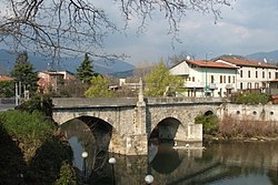
 Bridge over the Serio River | |
Location of Gorle  | |
 Gorle Location of Gorle in Italy  Gorle Gorle (Lombardy) | |
| Coordinates: 45°42′14″N 9°43′09″E | |
| Country | Italy |
| Region | Lombardy |
| Province | Province of Bergamo (BG) |
| Area | |
| • Total | 2.4 km2 (0.9 sq mi) |
| Elevation | 268 m (879 ft) |
| Population (Dec. 2004)[2] | |
| • Total | 5,506 |
| • Density | 2,300/km2 (5,900/sq mi) |
| Demonym(s) | Gorlesi |
| Time zone | UTC+1 (CET) |
| • Summer (DST) | UTC+2 (CEST) |
| Postal code | 24020 |
| Dialing code | 035 |
Gorle borders the following municipalities: Bergamo, Pedrengo, Ranica, Scanzorosciate, Seriate, Torre Boldone.
Demographic evolution

References
- "Superficie di Comuni Province e Regioni italiane al 9 ottobre 2011". Italian National Institute of Statistics. Retrieved 16 March 2019.
- "Popolazione Residente al 1° Gennaio 2018". Italian National Institute of Statistics. Retrieved 16 March 2019.
- All demographics and other statistics: Italian statistical institute Istat.
На других языках
- [en] Gorle, Lombardy
[ru] Горле (коммуна)
Горле (итал. Gorle) — коммуна в Италии, располагается в регионе Ломбардия, подчиняется административному центру Бергамо.Текст в блоке "Читать" взят с сайта "Википедия" и доступен по лицензии Creative Commons Attribution-ShareAlike; в отдельных случаях могут действовать дополнительные условия.
Другой контент может иметь иную лицензию. Перед использованием материалов сайта WikiSort.org внимательно изучите правила лицензирования конкретных элементов наполнения сайта.
Другой контент может иметь иную лицензию. Перед использованием материалов сайта WikiSort.org внимательно изучите правила лицензирования конкретных элементов наполнения сайта.
2019-2025
WikiSort.org - проект по пересортировке и дополнению контента Википедии
WikiSort.org - проект по пересортировке и дополнению контента Википедии