world.wikisort.org - Ireland
St Mullins (Irish: Tigh Moling, formerly anglicised as Timoling or Tymoling - 'homestead of Moling')[1][2] is a village on the eastern bank of the River Barrow in the south of County Carlow, Ireland. It is less than 2 km off the R729 regional road.
This article includes a list of general references, but it lacks sufficient corresponding inline citations. (February 2021) |
St Mullins
Tigh Moling | |
|---|---|
Village | |
 | |
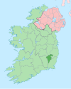
 St Mullins Location in Ireland | |
| Coordinates: 52°29′22″N 6°55′44″W | |
| Country | Ireland |
| Province | Leinster |
| County | Carlow |
| Irish Grid Reference | S7280838050 |
History
This section does not cite any sources. (September 2022) |

The village is named after Saint Moling (or Mo Ling, 614–697), who founded a monastery there in the early 7th century. The monastery was said to have been built with the help of "Gobán Saor", the legendary Irish builder. In the 8th-century manuscript, known as "The Book of Mulling", there is a plan of the monastery - the earliest known plan of an Irish monastery - which shows four crosses inside and eight crosses outside the circular monastic wall. It is said that St Moling dug a mile-long watercourse with his own hands to power his mill, a task that took seven years. He became Bishop of Ferns, died in 697 and is buried at St Mullins. The St Moling watercourse is still there, but the original monastery was plundered by vikings in 951 and was again burnt in 1138. An abbey was later built on the site.
A 9th-century high cross, showing the crucifixion and a Celtic spiral pattern, stands outside the remains of the abbey. There are also the remains of a Norman motte and some domestic medieval buildings, including one that has an unusual diamond-shaped window. St Moling's Mill and St Moling's Well are closeby.

In Irish folklore, St. Mullins is said to be the place where Suibhne Geilt dies, after having been welcome in the monastery by Saint Moling himself.

River Barrow
This section does not cite any sources. (September 2022) |

As well as being visited by anglers, St Mullins is one of the stop-off points for pleasure barges and cruisers who transit the River Barrow. The building of the canal on the Barrow began here in 1750 and the Old Grain Store was built to store goods coming up the river from the sailing ships in New Ross.
The horses and carts came down the tracks from the Blackstairs Mountains to gather their supplies and sell their goods for export. Horses were kept in the old stables to pull the barges up-river and the blacksmith was on hand to repair the barges and shoe the draught horses.
By 1920, the Bolinder engine had arrived and with motorized barges the long serving horses were no longer needed.
St Mullins is also the beginning and ending point for the Barrow Way long distance walk.
See also
- List of towns and villages in Ireland
References
- Placenames Order (An tOrdú Logainmneacha), 1975.
- St Mullin's, Placenames Database of Ireland. Retrieved 21 March 2013.
External links
Places in County Carlow | ||
|---|---|---|
County town: Carlow | ||
| Towns |
|  |
| Villages and townlands |
| |
| Baronies |
| |
| ||
На других языках
[de] St. Mullin’s
St. Mullin’s (irisch Tigh Moling, „Molings Haus“) ist ein kleines Dorf im irischen County Carlow. Es ist hauptsächlich durch die Ruinen einer frühchristlichen Klosteranlage bekannt.- [en] St Mullin's
[ru] Сент-Маллинс
Сент-Маллинс[1] (англ. St Mullin's; ирл. Tigh Moling)[2][3] — деревня в Ирландии, находится в графстве Карлоу (провинция Ленстер) на восточном берегу реки Барроу в двух километрах от региональной трассы R729.Другой контент может иметь иную лицензию. Перед использованием материалов сайта WikiSort.org внимательно изучите правила лицензирования конкретных элементов наполнения сайта.
WikiSort.org - проект по пересортировке и дополнению контента Википедии