world.wikisort.org - Ireland
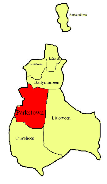
Parkstown is a townland in County Tipperary in Ireland. Occupying 624 acres, it is located in the civil parish of Ballymoreen[1] in the barony of Eliogarty in the poor law union of Thurles.
Parkstown
Baile na Páirce | |
|---|---|
townland | |
 Parkstown Location in Ireland | |
| Coordinates: 52.61640°N 7.76818°W | |
| Country | Ireland |
| Province | Munster |
| County | County Tipperary |
| Irish Grid Reference | S157517 |
Its name in Irish, Baile na Páirce, was, in mid-20th century, used as the official Irish name of the village of Horse and Jockey, the northern half of which is built on the townland, at its south-western corner;[2] it appeared on official road-signs and was the name used in the postmark at the post office in the village.[3]
Parkstown House
There is a townland house or estate house, Parkstown House.[4] The Lamphier family lived at Parkstown House from at least the 1770s; Thomas John Lanphier was the freeholder in 1776.[5] Henry Langley lived there in 1814 and John Pennefather Lamphier was living there in 1837 and in the early 1850s; he held the property, whose buildings were valued at more than £23, from the Court of Chancery and was the occupant at the time of its sale in 1852.[citation needed]
The Parkstown lands of the Lanphier family were part of the land which, in the mid-19th century, Vernon Lamphier (who was elected, on 3 October 1848, as rate collector for Moycarkey poor law district[6]) held from Viscount Hawarden.[7] The 385-acre estate of John P. Lanphier was advertised for sale in the Encumbered Estates' Court in April 1852. The property was held under a grant in perpetuity, dated 17 February 1852 and made by Wray Palliser, to John P. Lanphier and Vernon Lanphier.[citation needed]
Since the 1852 sale, the house and some of the land that forms part of Parkstown townland have passed through various hands, including families called O'Keeffe and Armitage; it has belonged to the Maher family since 1955. The building is still, in the early 21st century, a fine residence.[8]
Parkstown Castle
Just to the west of Parkstown House, roughly where the walled orchard now stands, is the site of a medieval castle, Parkstown Castle.[9]
References
- Samuel Lewis, Topographical Dictionary of Ireland, 1837, page 153
- "Ordnance Survey map". Archived from the original on 29 August 2012. Retrieved 23 September 2012.
- Irish Post Offices & Postmarks
- Entry for Parkstown House in the National Inventory of Architectural Heritage
- List of Freeholders of the County of Tipperary in the year 1776 Archived 2012-08-21 at the Wayback Machine
- Papers relating to proceedings for relief of distress, and state of unions and workhouses in Ireland, 1849
- Lanphier estate
- Entry for Parkstown House in the Landed Estates Database at the National University of Ireland, Galway
- Map of Parkstown House in the National Inventory of Architectural Heritage. This 19th-century map, part of the Ordnance Survey First Edition 6" Series, antedates the construction of the Thurles-Clonmel railway, since it does not show it at the Horse and Jockey.
Другой контент может иметь иную лицензию. Перед использованием материалов сайта WikiSort.org внимательно изучите правила лицензирования конкретных элементов наполнения сайта.
WikiSort.org - проект по пересортировке и дополнению контента Википедии